We are in the process of migrating all NASA Earth science data sites into Earthdata from now until end of 2026. Not all NASA Earth science data and resources will appear here until then. Thank you for your patience as we make this transition.
Read about the Web Unification Project
Filters
The AppEEARS QGIS Plugin enables users to browse completed requests from AppEEARS and load cloud-optimized GeoTIFF output files directly into QGIS.
News
June 23, 2025
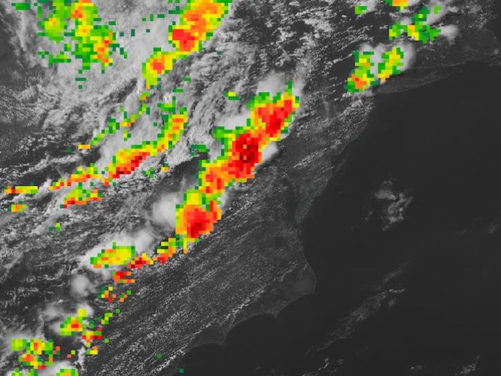
IMERG Precipitation Rate overlaid on base image captured by the ABI instrument aboard the GOES-East platform at 4:30pm ET on June 19, 2025.
Worldview Image of the Week
June 23, 2025

The Climate Prediction Center (CPC) 4 km Infrared (IR) dataset archive now extends back to January 1998, offering over 25 years of high-resolution infrared observations and continuing into the present.
News
June 20, 2025
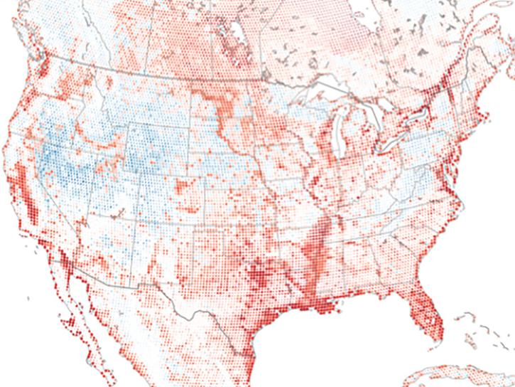
Researchers from Cornell's eBird project used observations from amateur birdwatchers and NASA data to better understand the decline in avian populations throughout North America.
News
June 17, 2025

The eBird project uses NASA data and observations from amateur birdwatchers to provide insights into the decline in avian populations throughout North America.
Data in Action
June 17, 2025

Follow these guidelines to ensure your NetCDF data meets NASA's data submission recommendations.
Data Basics
June 17, 2025

Follow these guidelines when formatting CSV files for submission to NASA's data centers.
Data Basics
June 17, 2025
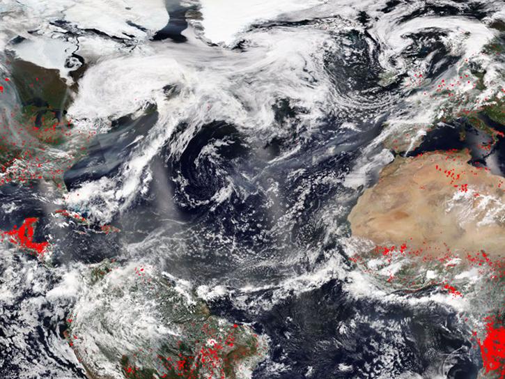
FIRMS was used to track the spread of smoke plumes during the Canadian wildland fires in June 2025.
Blog
June 17, 2025
SHOWING 8 OF 2379