We are in the process of migrating all NASA Earth science data sites into Earthdata from now until end of 2026. Not all NASA Earth science data and resources will appear here until then. Thank you for your patience as we make this transition.
Read about the Web Unification Project
Filters
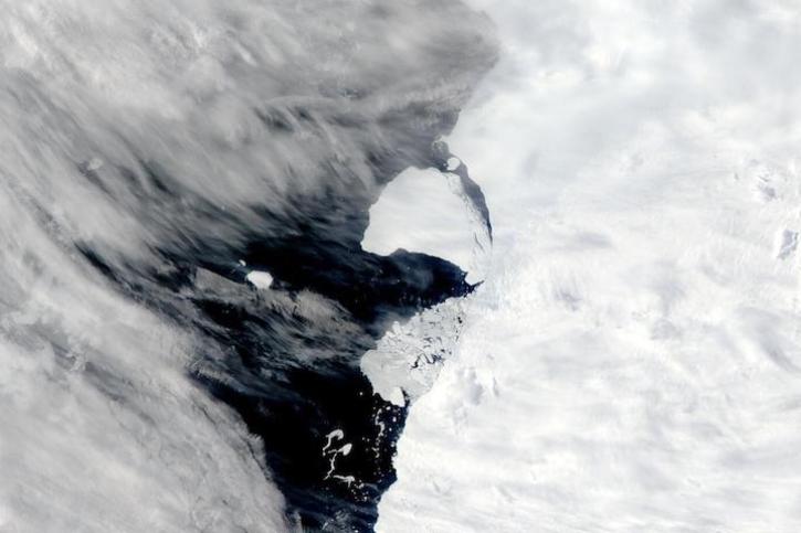
Image captured on Jan 29, 2023, by the MODIS instrument aboard NASA's Aqua satellite.
Worldview Image of the Week
Jan. 31, 2023
Through the agreement, NASA geospatial data will be increasingly available to more than 10 million users of geographic information system (GIS) software in ArcGIS and open geospatial consortium (OGC)-based formats.
News
Jan. 31, 2023

NASA near real-time data help Lori Schultz respond to agencies that reach out to NASA in the wake of natural disasters.
Data User Story
Jan. 31, 2023

MODIS V6 land data products suffer from known calibration issues discovered after the completion of V6 reprocessing.
News
Jan. 30, 2023

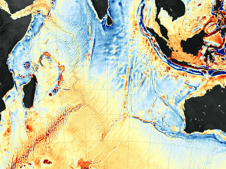
Image of a three-day flood composite ending Jan 23, 2023, from the MODIS instruments aboard the Terra and Aqua satellites.
Worldview Image of the Week
Jan. 24, 2023

The SDE facilitates discovery and access to scientific data and resources across NASA’s Science Mission Directorate.
Feature Article
Jan. 20, 2023

Image captured on Jan 19, 2023, by the VIIRS instrument aboard the joint NASA/NOAA Suomi NPP satellite.
Worldview Image of the Week
Jan. 19, 2023
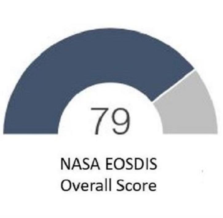
The results of the 2022 American Customer Satisfaction Index show users continue to appreciate EOSDIS products and services.
Feature Article
Jan. 17, 2023
SHOWING 8 OF 2379