We are in the process of migrating all NASA Earth science data sites into Earthdata from now until end of 2026. Not all NASA Earth science data and resources will appear here until then. Thank you for your patience as we make this transition.
Read about the Web Unification Project
Filters


Convection meets the Indian Ocean for supersize weather.
Feature Article
Dec. 27, 2020

ESDS program elements AGU sessions, posters, e-lightning talks and workshops for the Virtual Fall AGU 2020.
Feature Article
Dec. 1, 2020
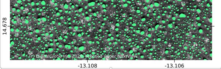
Using commercial satellite data and machine learning, scientists discovered a surprisingly large number of trees in Africa's drylands.
Feature Article
Nov. 19, 2020

A new article authored by members of NASA's Earth Science Data Systems program and the Radiant Earth Foundation was published in the American Geophysical Union's Eos.
Feature Article
Nov. 17, 2020
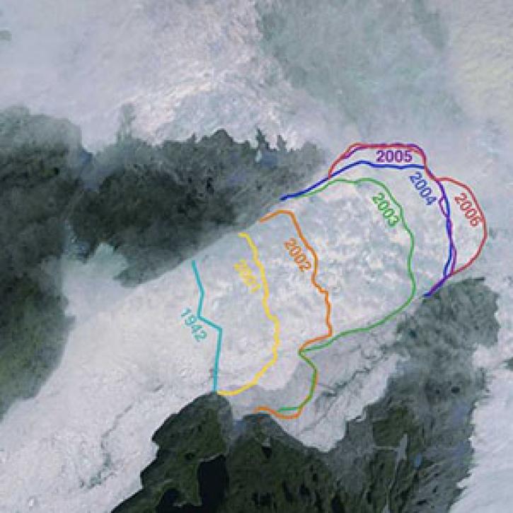
Greenland’s more than 200 major outlet glaciers are constantly on the move—many of them at some of the fastest speeds ever recorded.
Feature Article
Nov. 4, 2020

NASA's SMAP team turns raw satellite data into more than a dozen data products for data users around the world.
Feature Article
Nov. 4, 2020

Explore and download data and imagery from EOSDIS for the the Nepalese region affected by the earthquake on April 25, 2015 and aftershocks.
Feature Article
Nov. 4, 2020
SHOWING 8 OF 534