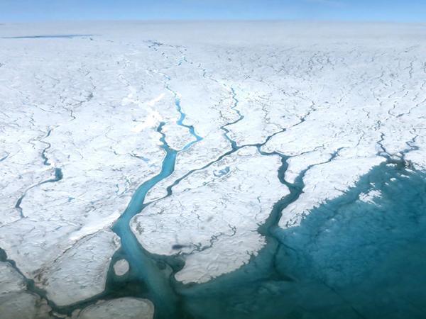
OMG used NASA's G-III to fly the Glacier and Ice Surface Topography Interferometer (GLISTIN-A) in order to generate high resolution, high precision elevation measurements of Greenland’s coastal glaciers during the spring. Annual surveys by GLISTIN-A measured glacier thinning and retreat over the preceding season. A second aircraft campaign occurred each summer to deploy 250 expendable temperature and salinity probes along the continental shelf to measure the volume and extent of warm, salty Atlantic water. These data, along with fundamental new and critical observations of airborne marine gravity and ship-based observations of the sea floor geometry, provided a revolutionary dataset for understanding ocean/ice interactions and led to improved estimates of global sea level rise.
OMG
Oceans Melting Greenland (OMG) was a 5-year NASA Earth Venture Suborbital (EVS-2) mission that aims to improve estimates of sea level rise by addressing the question: To what extent are the oceans melting Greenland’s ice from below?
OMG observed changing water temperatures on the continental shelf surrounding Greenland and how marine glaciers react to the presence of warm, salty Atlantic water. The complicated geometry of the sea floor steers currents on the shelf and often determines whether Atlantic water can reach into the long narrow fjords and interact with the coastal glaciers. Because knowledge of these pathways is a critical component of modeling the interaction between the oceans and ice sheet, OMG facilitated improved measurements of the shape and depth of the sea floor in key regions.
Principal Investigator
Data Centers
Funding Programs
| Study Dates | July 25, 2015 - Sept. 16, 2021 |
|---|---|
| Season of Study | Boreal fall, boreal spring, boreal summer, cold, warm |
| Region | Greenland |
| Spatial Bounds | N: 84°N S: 59°N W: 73°W E: 7°W |
| Focus Areas | Climate Variability and Change |
| Geophysical Concepts | Ice and Glacial Properties and Processes Ocean Properties and Processes |
| Scientific Topics | Sea Level Rise Sea Surface Temperature Ocean Temperature Glaciers Ice Ice Loss Ocean/Ice Interactions Glacier Topography Ice Surface Topography |
The following resources provide additional information about the OMG project.