We are in the process of migrating all NASA Earth science data sites into Earthdata from now until end of 2026. Not all NASA Earth science data and resources will appear here until then. Thank you for your patience as we make this transition.
Read about the Web Unification Project
Suomi NPP Resources
Suomi NPP News
View All News
Filters

With our latest release, version 3.8.2, vector capabilities have been extended to the Fire and Thermal Anomalies layers.
Blog
Nov. 13, 2020

Image of Precipitation Rate on 1 November 2020 from IMERG.
Worldview Image of the Week
Nov. 9, 2020
VIIRS I-band (375 m) Active Fire and Corrected Reflectance products are the newest near real-time products available through LANCE.
News
Nov. 4, 2020

Explore and download data and imagery from EOSDIS for the the Nepalese region affected by the earthquake on April 25, 2015 and aftershocks.
Feature Article
Nov. 4, 2020
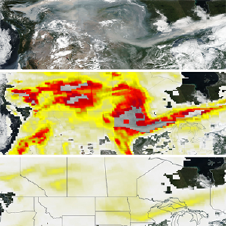
The new PyroCumuloNimbus product for the Ozone Mapping and Profiler Suite (OMPS) makes it easier to track and analyze high concentrations of aerosols from wildfires and similar events.
Feature Article
Nov. 4, 2020

NASA's OMI and OMPS Science Investigator-led Processing Systems (SIPS) ensure that ozone data collected by instruments aboard the Aura and Suomi-NPP satellites reach global users.
Feature Article
Nov. 4, 2020

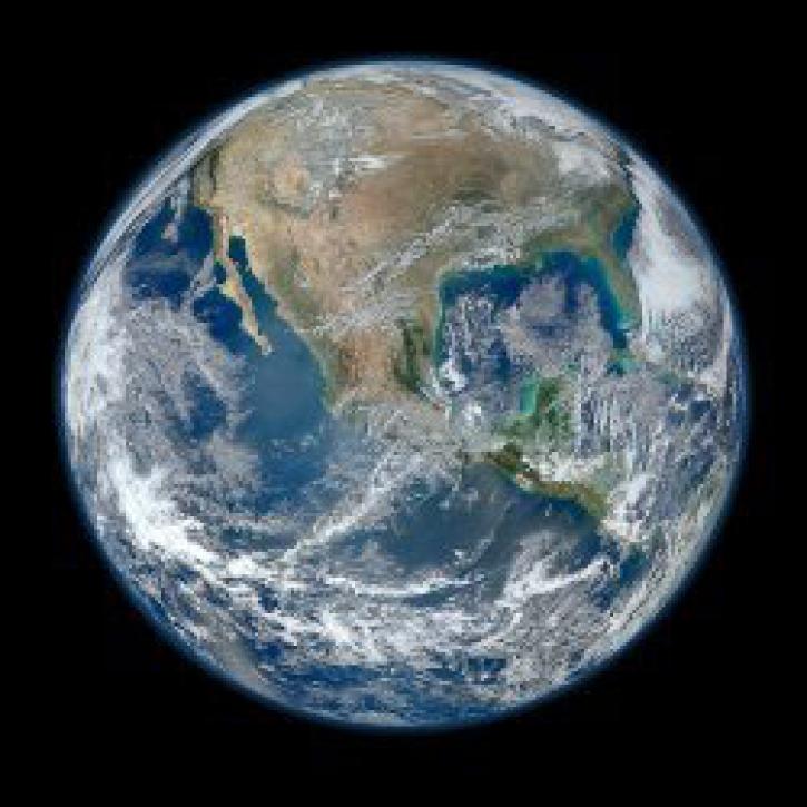
Interactively explore your world your way with nearly 20 years of MODIS global imagery and the EOSDIS Worldview data visualization application.
Feature Article
Nov. 4, 2020
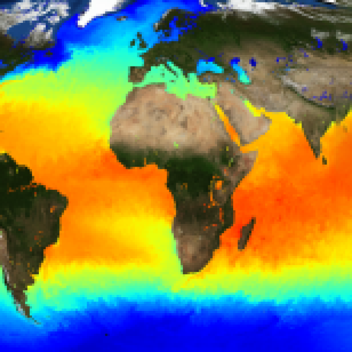
The public release of the NAVO GHRSST Level 4 K10-SST GDS2.0 product provides global daily analyzed SST at a 1-meter reference depth.
News
Nov. 4, 2020
SHOWING 8 OF 330
Frequently Asked Questions
Earthdata Forum
Our online forum provides a space for users to browse thousands of FAQs about research needs, data, and data applications. You can also submit new questions for our experts to answer.
Submit Questions to Earthdata Forumand View Expert Responses