We are in the process of migrating all NASA Earth science data sites into Earthdata from now until end of 2026. Not all NASA Earth science data and resources will appear here until then. Thank you for your patience as we make this transition.
Read about the Web Unification Project
Suomi NPP Resources
Suomi NPP News
View All News
Filters

This ArcGIS StoryMap highlights Data User Profiles, Learning Resources and Worldview imagery layers in support of Earth Day 2021.
Feature Article
April 19, 2021
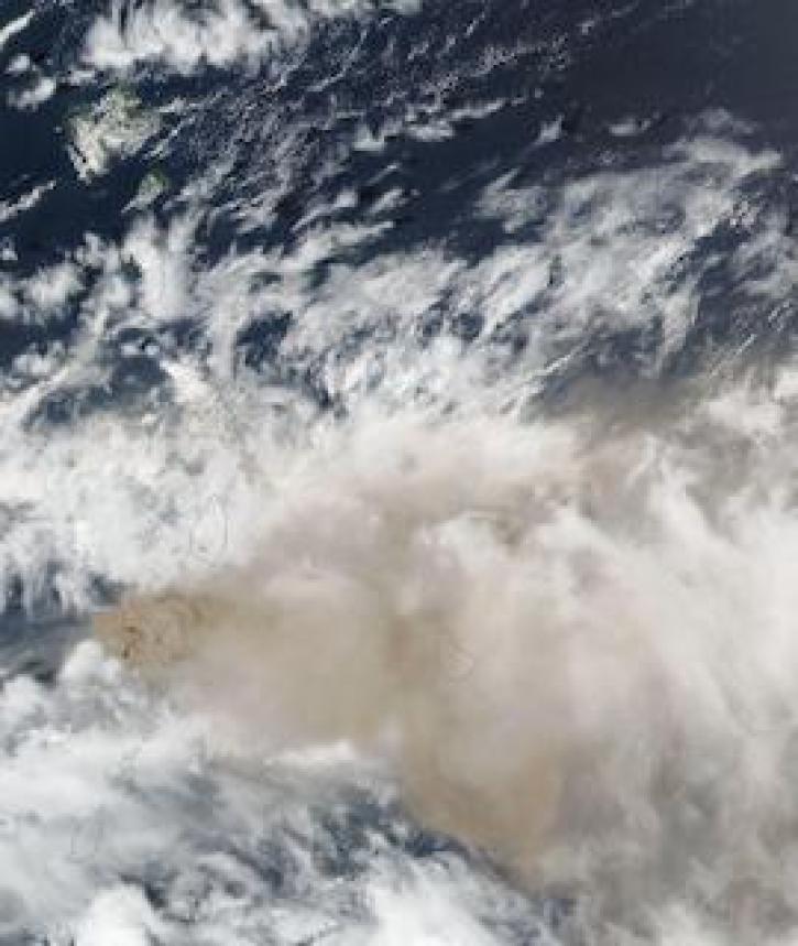
Image captured on 10 April 2021, by the VIIRS instrument, aboard the joint NASA/NOAA Suomi NPP satellite.
Worldview Image of the Week
April 19, 2021

NASA’s worldwide Fire Information for Resource Management System (FIRMS) provides vital near real-time tools for managing wildland fires.
Feature Article
April 15, 2021

A new Fire Information for Resource Management System (FIRMS) focused on the US and Canada provides expanded capabilities including additional map layers, ownership boundaries, and daily fire dangers.
News
April 13, 2021

Imagery of Earth at night provide unique opportunities for research. Dr. Miller uses these data in his studies of Earth’s nocturnal environment.
Data User Story
April 13, 2021

The provisional public release of the Harmonized Landsat Sentinel-2 (HLS) dataset through NASA’s LP DAAC opens new avenues for global terrestrial research.
Feature Article
April 12, 2021
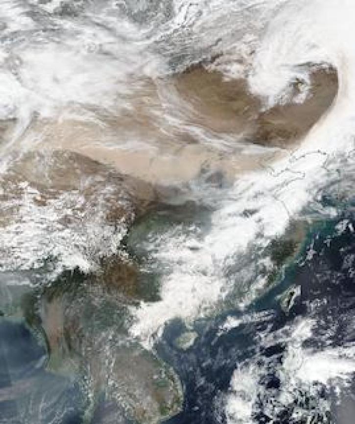
Image captured on 15 March 2021, by the VIIRS instrument, aboard the joint NASA/NOAA Suomi NPP satellite.
Worldview Image of the Week
April 12, 2021
Near real-time data products from the Ozone Mapping and Profiler Suite (OMPS) provide valuable information about atmospheric ozone and sulfur dioxide concentrations.
News
April 5, 2021
SHOWING 8 OF 330
Frequently Asked Questions
Earthdata Forum
Our online forum provides a space for users to browse thousands of FAQs about research needs, data, and data applications. You can also submit new questions for our experts to answer.
Submit Questions to Earthdata Forumand View Expert Responses