We are in the process of migrating all NASA Earth science data sites into Earthdata from now until end of 2026. Not all NASA Earth science data and resources will appear here until then. Thank you for your patience as we make this transition.
Read about the Web Unification Project
NOAA-21 Resources
NOAA-21 Learning Resources

LANCE near real-time products enable the management of ongoing events; standard data products are heavily processed and intended for scientific research.
Data Basics
July 15, 2021

Join us to learn how to use NASA’s Worldview, an imagery mapping and visualization tool that provides access to over 900 data imagery layers, many of which are available within hours, even minutes, to explore Earth’s interconnected processes and events.
Webinar
May 26, 2021

Read highlights of three publications that detail how NASA Earth observation data informs forest structure mapping, disease vector tracking, and mineral identification.
Data in Action
April 26, 2021

During this webinar we will introduce several of the NSIDC DAAC snow-focused NASA missions and data products, followed by a live demonstration teaching participants how to discover, access, and couple snow data across varying geospatial scales using Python.
Webinar
Nov. 4, 2020

This ARSET training covers how to access VIIRS data products, the differences between VIIRS and MODIS, and its air quality applications.
Training
Oct. 22, 2020

This ArcGIS Python Toolbox simplifies access to quality data by decoding complex quality information into usable thematic raster files.
Tutorial
Aug. 18, 2020

This ARSET training focuses on the use of remote sensing to understand global phenology.
Training
June 30 - July 14, 2020

During this webinar we will provide answers to commonly asked questions about NASA land processes data, services and tools, and show you how to navigate the new LP DAAC website to discover data resources.
Webinar
Jan. 15, 2020
SHOWING 8 OF 26
NOAA-21 News
View All News
Filters
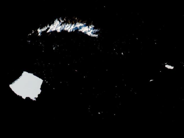
Image captured on May 3, 2025, by the VIIRS instrument aboard the joint NASA/NOAA NOAA-21 platform.
Worldview Image of the Week
May 8, 2025
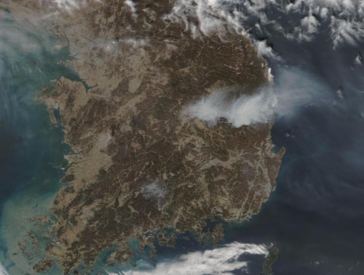
Image captured on Mar 26, 2025, by the VIIRS instrument aboard the joint NASA/NOAA NOAA-21 platform.
Worldview Image of the Week
March 27, 2025
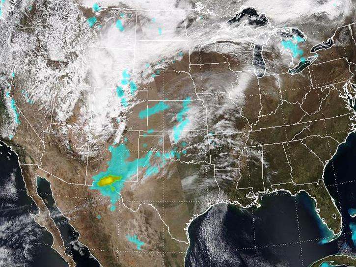
Spring 2025 has been an unusually active period for dust storms over the Southwestern U.S.
News
March 25, 2025

The atlas now features NASA Earth science data formatted specifically for geographic information systems (GIS) users.
Feature Article
Jan. 7, 2025

Image captured on January 2, 2025, by the VIIRS instrument aboard the NOAA-21 platform.
Worldview Image of the Week
Jan. 3, 2025
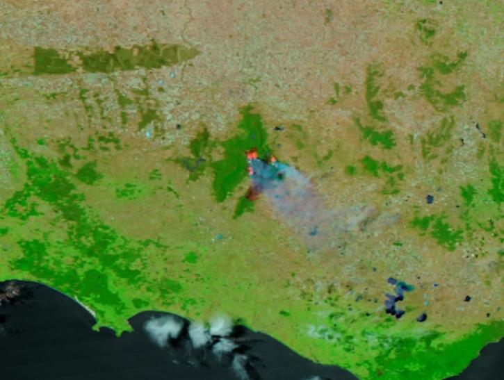
Image captured on Dec 25, 2024, by the VIIRS instrument aboard the NOAA-21 platform.
Worldview Image of the Week
Dec. 26, 2024
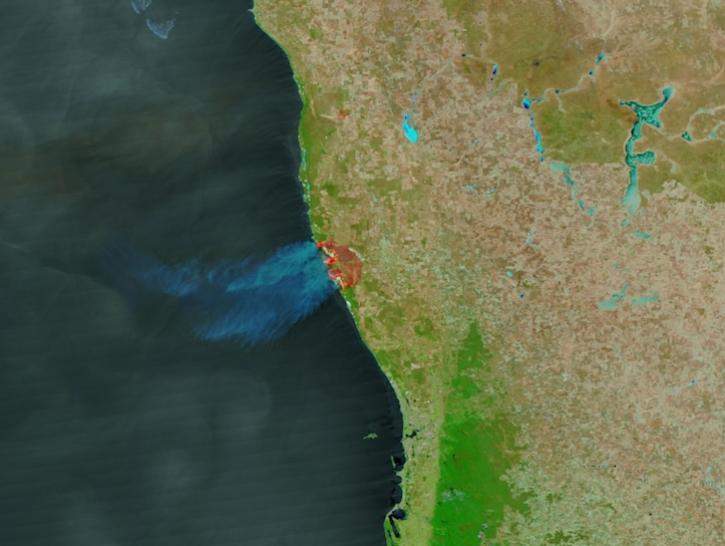
Image captured on Nov 28, 2024, by the VIIRS instrument aboard the NOAA-21 platform.
Worldview Image of the Week
Nov. 29, 2024

A summary of datasets, products, and resources released by NASA’s Distributed Active Archive Centers (DAACs) in October 2024.
News
Nov. 4, 2024
SHOWING 8 OF 72
Frequently Asked Questions
Earthdata Forum
Our online forum provides a space for users to browse thousands of FAQs about research needs, data, and data applications. You can also submit new questions for our experts to answer.
Submit Questions to Earthdata Forumand View Expert Responses