We are in the process of migrating all NASA Earth science data sites into Earthdata from now until end of 2026. Not all NASA Earth science data and resources will appear here until then. Thank you for your patience as we make this transition.
Read about the Web Unification Project
Aqua Resources
Earthdata resources for users working with NASA’s Aqua data include tutorials and other learning resources, news announcements such as instrument updates and data releases, user guides and related documents, and frequently asked questions.
Aqua News
View All News
Filters

The graphic image interface was retired due to failing channels on the AMSU instrument.
News
Nov. 20, 2018

See a list of the most recent GIBS and Worldview imagery additions.
Blog
Sept. 1, 2017
Issues with VIIRS near real-time products and some MODIS near real-time atmosphere products have been resolved.
Blog
March 23, 2017
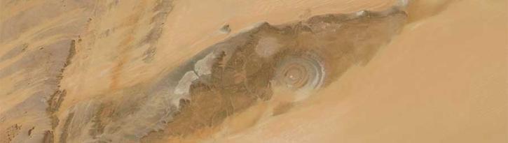
Image captured on 12 February 2017 by the MODIS instrument, aboard the Aqua satellite.
Worldview Image of the Week
Feb. 13, 2017

Image captured on 12 September 2016 by the MODIS instrument, aboard the Aqua satellite.
Worldview Image of the Week
Sept. 12, 2016
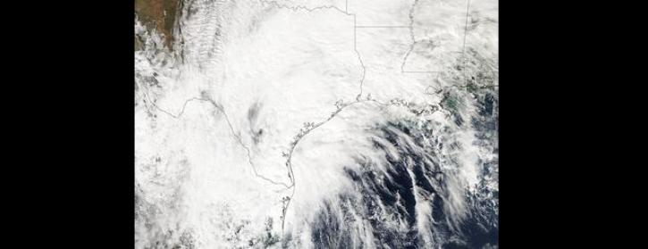
Image captured by the MODIS instrument, aboard the Aqua satellite, on 24 October 2015
Worldview Image of the Week
Oct. 26, 2015

Access Moderate Resolution Imaging Spectroradiometer (MODIS) Version 6 data starting in August 2015.
News
July 23, 2015
New imagery products are now available in GIBS in the Geographic, North Polar Stereographic, South Polar Stereographic, and Web Mercator projections.
Blog
Sept. 22, 2014
SHOWING 8 OF 356
Frequently Asked Questions
Earthdata Forum
Our online forum provides a space for users to browse thousands of FAQs about research needs, data, and data applications. You can also submit new questions for our experts to answer.
Submit Questions to Earthdata Forumand View Expert Responses