We are in the process of migrating all NASA Earth science data sites into Earthdata from now until end of 2026. Not all NASA Earth science data and resources will appear here until then. Thank you for your patience as we make this transition.
Read about the Web Unification Project
Sentinel-1 C-SAR Resources
Earthdata resources for users working with NASA’s Sentinel-1 C-band Synthetic Aperture Radar data include tutorials and other learning resources, news announcements such as instrument updates and data releases, user guides and related documents, and frequently asked questions.
Sentinel-1 C-SAR Learning Resources

This ARSET training covers different techniques for applying synthetic aperture radar to disaster, water, and land cover applications.
Training
Aug. 7-16, 2018
Esta capacitación de ARSET cubre técnicas para utilizar radar de apertura sintética (SAR) en aplicaciones para desastres, agua y cobertura terrestre.
Training
Aug. 7-16, 2018

Sentinel-1 synthetic aperture radar (SAR) imagery is sensitive to standing water, making it an ideal tool for mapping the extent of floodwater covering an area.
Data Recipe
Dec. 3, 2017

This data recipe shows users how to geocode Sentinel-1 GRD products in QGIS 2.18 using the Warp (Reproject) tool.
Data Recipe
Oct. 18, 2017

This data recipe walks users through geocoding Sentinel-1 GRD products in QGIS 3.X using the Warp (Reproject) tool.
Data Recipe
Oct. 18, 2017

Esta capacitación cubre habilidades para adquirir y comprender datos de radar de apertura sintética (SAR) y sus aplicaciones.
Training
June 28 - July 6, 2017
This ARSET training focuses on building the skills needed to acquire and understand synthetic aperture radar data as well as potential applications.
Training
June 28 - July 6, 2017

This ARSET training covers how to access and apply satellite data relevant to land indicators, such as estimating total forest area and forest change.
Training
June 20-22, 2017
SHOWING 8 OF 57
Two NASA GIBS-based projects are Global Winners in the 2016 NASA Space Apps Challenge
News
Nov. 4, 2020

NASA's SMAP team turns raw satellite data into more than a dozen data products for data users around the world.
Feature Article
Nov. 4, 2020
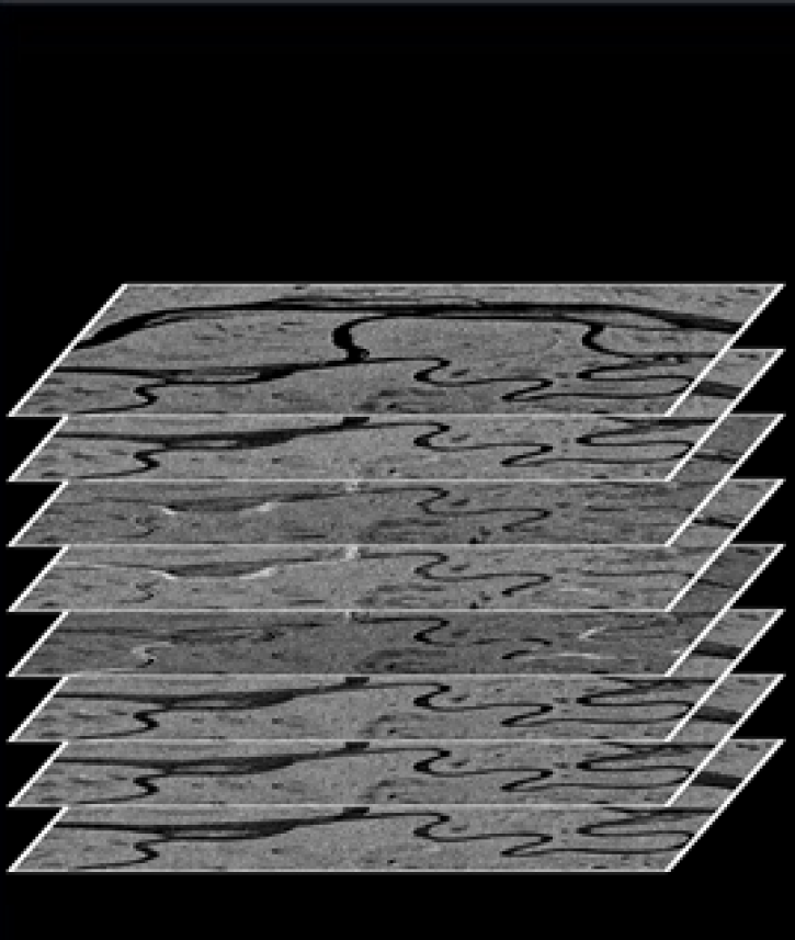
The ASF DAAC’s RTC Stacking Tool helps facilitate time-series analysis.
Feature Article
Nov. 4, 2020

A researcher pushes the limits of radar data to monitor small rice fields in the Philippines.
Feature Article
July 28, 2020
SHOWING 4 OF 38
Frequently Asked Questions
Earthdata Forum
Our online forum provides a space for users to browse thousands of FAQs about research needs, data, and data applications. You can also submit new questions for our experts to answer.
Submit Questions to Earthdata Forumand View Expert Responses