We are in the process of migrating all NASA Earth science data sites into Earthdata from now until end of 2026. Not all NASA Earth science data and resources will appear here until then. Thank you for your patience as we make this transition.
Read about the Web Unification Project
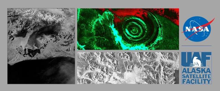
Sentinel-1 C-SAR Resources
Earthdata resources for users working with NASA’s Sentinel-1 C-band Synthetic Aperture Radar data include tutorials and other learning resources, news announcements such as instrument updates and data releases, user guides and related documents, and frequently asked questions.
Sentinel-1 C-SAR Learning Resources
NASA's ASF DAAC has rolled out the first tool in its planned Advanced Products Toolbox for synthetic aperture radar (SAR) data with a single-command Radiometrically Terrain-Correct (RTC) tool. Join us for the tool demo and provide your input.
Webinar
Nov. 4, 2020
This webinar will provide a basic introduction to SAR data collection, the datasets that are available from NASA's Alaska Satellite Facility Distributed Active Archive Center and the processing required to extract useful information from the data.
Webinar
July 10, 2020
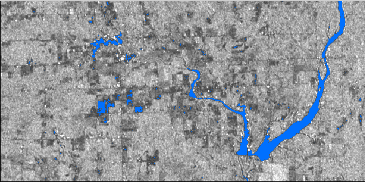
In this webinar, we will demonstrate approaches for using SAR datasets in GIS environments to detect landscape change and map flooding events with a focus on Sentinel-1 datasets.
Webinar
July 10, 2020

Researchers used NASA satellite data to improve water resource management in South and Southeast Asia.
Data in Action
May 13, 2020

Esta capacitación de ARSET introduce cómo usar datos SAR para mapear y monitorear cambios en los bosques, la cobertura terrestre y los manglares.
Training
May 12-31, 2020
This ARSET training introduces how to use SAR data to map and monitor forest change, land cover, and mangroves.
Training
May 12-31, 2020

This ARSET training involves a Q&A on using synthetic aperture radar (SAR) data.
Training
July 17, 2019

This data recipe walks users through the Offset Tracking tools to generate glacier velocity maps with Sentinel-1 Level-1 Ground Range Detected products.
Data Recipe
Feb. 18, 2019
SHOWING 8 OF 57

For the people of Asia and Southeast Asia, water is integral to their livelihood. Dr. Hossain uses NASA Earth observing data to improve water management and accelerate economic development in these regions.
Data User Story
April 22, 2021
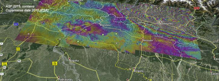
Ground deformation caused by the April 25 Nepal earthquake is clearly visible in this new interferogram processed from Sentinel-1A data by ASF DAAC scientists Franz Meyer and Wenyu Gong.
News
March 30, 2021

The upcoming NISAR satellite mission is expected to add as much as 85 TB of data each day to the EOSDIS archive. The commercial cloud is being explored as a way to archive and disseminate this extremely high volume of data efficiently.
Feature Article
Feb. 25, 2021

Who uses NASA Earth science data? Dr. Piyush Agram, for developing Synthetic Aperture Radar (SAR) data products.
Data User Story
Dec. 22, 2020
SHOWING 4 OF 38
Frequently Asked Questions
Earthdata Forum
Our online forum provides a space for users to browse thousands of FAQs about research needs, data, and data applications. You can also submit new questions for our experts to answer.
Submit Questions to Earthdata Forumand View Expert Responses