We are in the process of migrating all NASA Earth science data sites into Earthdata from now until end of 2026. Not all NASA Earth science data and resources will appear here until then. Thank you for your patience as we make this transition.
Read about the Web Unification Project
SeaWiFS Resources
Earthdata resources for users working with NASA’s Sea-viewing Wide Field of View Sensor (SeaWiFS) data include tutorials and other learning resources, news announcements such as instrument updates and data releases, user guides and related documents, and frequently asked questions.
SeaWiFS Learning Resources

Learn how SeaBASS can be leveraged for data search, discovery, and access, and will demonstrate how SeaBASS supports NASA’s ocean color satellite products and the broader scientific community.
Webinar
April 18, 2022

This webinar demonstrates the capabilities and use of SeaDAS (Version 7 and later), NASA's free and publicly available software which enables users from their standard desktop and laptop computers to process,visualize, and analyze remote sensing data.
Webinar
April 15, 2022
SHOWING 2 OF 2
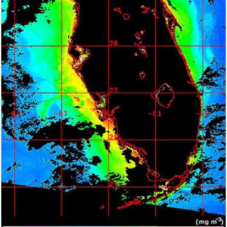
Scientists use SeaWiFS and MODIS to detect harmful algal blooms.
Feature Article
July 22, 2020
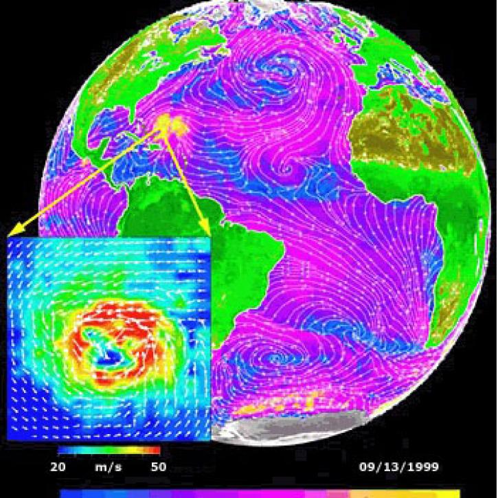
Data from NASA satellites allow researchers to detect potential hurricanes up to two days earlier than with traditional forecasting methods.
Feature Article
July 22, 2020

Ocean color data from the SeaWiFS and MODIS sensors enable researchers to examine the link between phytoplankton blooms and fish and bird health.
Feature Article
July 21, 2020

Access the presentations and final report from the MODIS Calibration Review Panel.
Event
Feb. 11, 2004
SHOWING 4 OF 36
Frequently Asked Questions
Earthdata Forum
Our online forum provides a space for users to browse thousands of FAQs about research needs, data, and data applications. You can also submit new questions for our experts to answer.
Submit Questions to Earthdata Forumand View Expert Responses