We are in the process of migrating all NASA Earth science data sites into Earthdata from now until end of 2026. Not all NASA Earth science data and resources will appear here until then. Thank you for your patience as we make this transition.
Read about the Web Unification Project
OLI Resources
Earthdata resources for users working with NASA’s Operational Land Imager (OLI) include tutorials and other learning resources, news announcements such as instrument updates and data releases, user guides and related documents, and frequently asked questions.
OLI Learning Resources

This ARSET training provides an overview of NASA resources for monitoring climate change and its impacts.
Training
Sept. 29 - Oct. 6, 2021

Esta capacitación de ARSET cubre similitudes y diferencias entre MODIS y VIIRS para monitoreo de calidad del agua.
Training
Sept. 14-21, 2021
This ARSET training provides an overview of the similarities and differences between MODIS and VIIRS for water quality monitoring.
Training
Sept. 14-21, 2021

This ARSET training provides an overview of species distribution models and how to use remote sensing data for landscape characterization.
Training
Aug. 12-19, 2021

Read highlights of three publications that detail how NASA Earth observation data informs earthquake prediction, the effects of wildfires on vegetation, and the impact of agriculture on African birds.
Data in Action
July 19, 2021

NASA DEVELOP participants used satellite data to identify priority areas for heat relief in Tempe, Arizona, creating tools to guide city officials in implementing targeted mitigation strategies.
Data in Action
June 29, 2021

This ARSET training covers the Google Earth Engine Code Editor and hands-on exercises for processes integral to optical imagery analysis.
Training
June 16-30, 2021

This ARSET training introduces how NASA earth observations can contribute to a greater understanding of energy management applications.
Training
June 1-22, 2021
SHOWING 8 OF 82

New surface water extent and surface disturbance products from a NASA effort are providing needed resources to federal agencies.
Feature Article
June 15, 2023

Data from NASA’s Land Processes DAAC help Dr. Helen Poulos understand climate-induced change in the forests of the Southwestern U.S.
Data User Story
May 25, 2023

The release of the HLS codebase gives product users greater visibility into the project’s image processing pipeline.
News
May 19, 2023
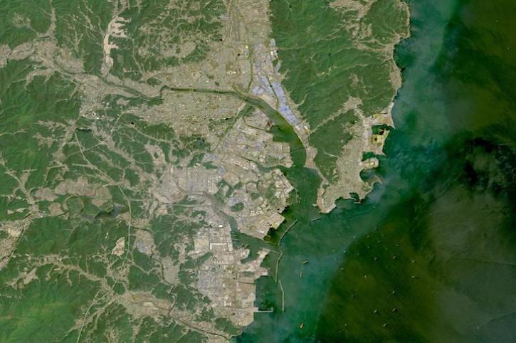
Image captured on May 1, 2023, by the OLI instrument aboard the Landsat 8 and 9 satellites.
Worldview Image of the Week
May 4, 2023
SHOWING 4 OF 66
Frequently Asked Questions
Earthdata Forum
Our online forum provides a space for users to browse thousands of FAQs about research needs, data, and data applications. You can also submit new questions for our experts to answer.
Submit Questions to Earthdata Forumand View Expert Responses