We are in the process of migrating all NASA Earth science data sites into Earthdata from now until end of 2026. Not all NASA Earth science data and resources will appear here until then. Thank you for your patience as we make this transition.
Read about the Web Unification Project
OLI Resources
Earthdata resources for users working with NASA’s Operational Land Imager (OLI) include tutorials and other learning resources, news announcements such as instrument updates and data releases, user guides and related documents, and frequently asked questions.
OLI Learning Resources

This ARSET training provides an overview of citizen science efforts that use Earth Observations and how to engage community to achieve project goals.
Training
Jan. 24-31, 2023
Esta capacitación de ARSET cubre la ciencia ciudadana con observaciones terrestres y cómo involucrar a la comunidad en proyectos.
Training
Jan. 24-31, 2023

This ARSET training focuses on developments and updates in flood monitoring tools and flood modeling techniques.
Training
Sept. 14-21, 2022

This ARSET training outlines the basics of ecosystem services and natural capital accounting.
Training
Aug. 23-30, 2022

This ARSET training provides hands-on exercises to measure urban heat islands and construct heat vulnerability indices.
Training
Aug. 2-11, 2022

This ARSET training focuses on using NASA data products for monitoring human settlements and landscapes during armed conflict and forced displacement.
Training
June 14-23, 2022

This ARSET training focuses on introducing evapotranspiration (ET) products derived from remote sensing observations.
Training
June 1-15, 2022
Learn about the technical details of the Harmonized Landsat Sentinel-2 (HLS) effort from NASA and ESA (European Space Agency) presenters along with data product status and availability.
Webinar
May 19, 2022
SHOWING 8 OF 82

New surface water extent and surface disturbance products from a NASA effort are providing needed resources to federal agencies.
Feature Article
June 15, 2023

Data from NASA’s Land Processes DAAC help Dr. Helen Poulos understand climate-induced change in the forests of the Southwestern U.S.
Data User Story
May 25, 2023

The release of the HLS codebase gives product users greater visibility into the project’s image processing pipeline.
News
May 19, 2023
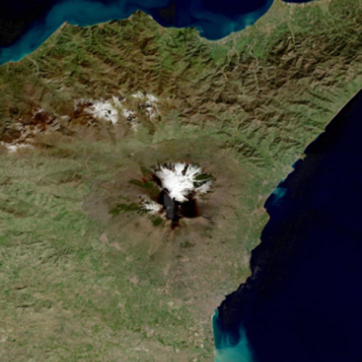
Image captured on May 1, 2023, by the OLI instrument aboard the Landsat 8 and 9 satellites.
Worldview Image of the Week
May 4, 2023
SHOWING 4 OF 66
Frequently Asked Questions
Earthdata Forum
Our online forum provides a space for users to browse thousands of FAQs about research needs, data, and data applications. You can also submit new questions for our experts to answer.
Submit Questions to Earthdata Forumand View Expert Responses