We are in the process of migrating all NASA Earth science data sites into Earthdata from now until end of 2026. Not all NASA Earth science data and resources will appear here until then. Thank you for your patience as we make this transition.
Read about the Web Unification Project
GMI Resources
Read the latest Global Precipitation Measurement (GPM) Microwave Imager (GMI) news and access learning resources designed to help you optimize your Earth science research.
GMI Learning Resources

This ARSET training covers the NASA data and tools useful for monitoring tropical storms.
Training
May 3-10, 2018

This ARSET training introduces the Variable Infiltration Capacity Model, sources of satellite-derived input data, and implementation of the model.
Training
Feb. 15 - March 1, 2018

Learn now NASA's Soil Moisture Active Passive (SMAP) satellite and other satellite instruments were used to create a comprehensive chronology of the flood from land to ocean.
Data in Action
Dec. 6, 2016

This ARSET training introduces NASA data products for water resources.
Training
Oct. 13 - Nov. 10, 2015

This ARSET training focuses on regional and global observation resources for conservation management.
Training
May 5 - June 2, 2015
SHOWING 5 OF 29

The TiTiler-CMR service generates dynamic, on-demand map tile layers that can be incorporated into GIS software and visualization applications. Two NASA mapping applications – Worldview and FIRMS – have harnessed the versatility of this service.
Feature Article
April 29, 2026

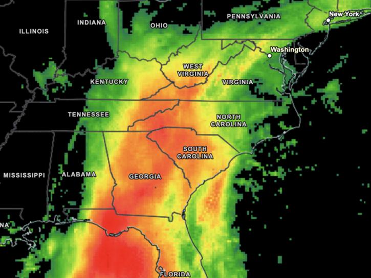
Data overlays from Worldview show precipitation rates and sea surface temperatures in mid-April 2026, as the storm moved across the western Pacific.
Worldview Image of the Week
April 17, 2026
Visualize daily-average and 30-minute IMERG precipitation estimates.
News
Nov. 21, 2025
A summary of datasets, products, and resources released by NASA’s Distributed Active Archive Centers (DAACs) in June 2025.
News
July 18, 2025
SHOWING 4 OF 27
Frequently Asked Questions
Earthdata Forum
Our online forum provides a space for users to browse thousands of FAQs about research needs, data, and data applications. You can also submit new questions for our experts to answer.
Submit Questions to Earthdata Forumand View Expert Responses