We are in the process of migrating all NASA Earth science data sites into Earthdata from now until end of 2026. Not all NASA Earth science data and resources will appear here until then. Thank you for your patience as we make this transition.
Read about the Web Unification Project
AVIRIS-C Resources
Earthdata resources for users working with NASA’s Airborne Visible InfraRed Imaging Spectrometer (AVIRIS) data include tutorials and other learning resources, news announcements such as instrument updates and data releases, user guides and related documents, and frequently asked questions.

Who uses NASA Earth science data? Dr. Nancy Glenn, to study dryland ecosystems.
Data User Story
April 22, 2021
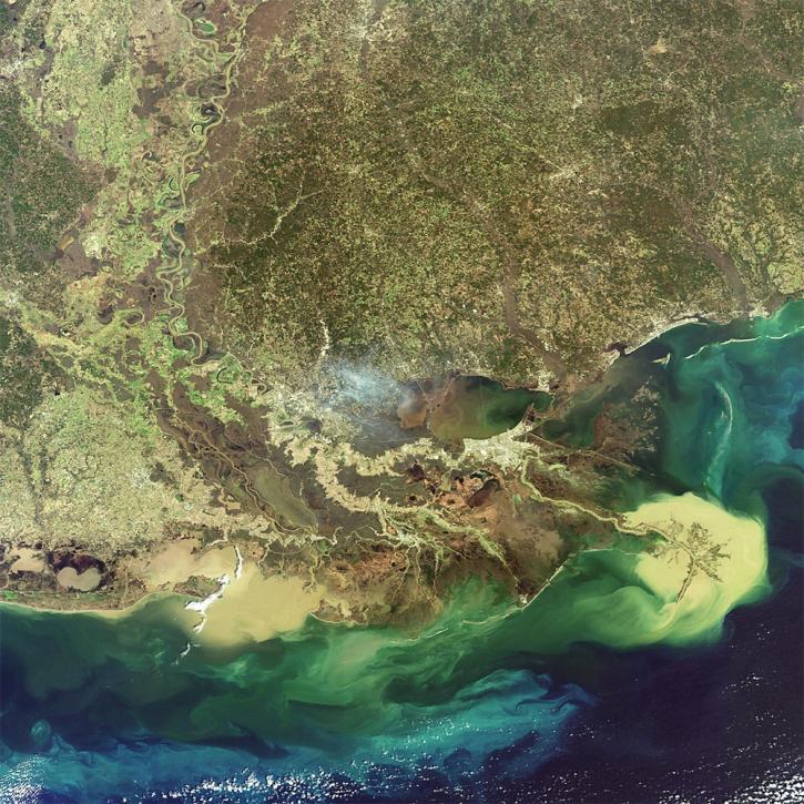
NASA researchers are using high resolution airborne data to determine the vulnerability and resilience of the Mississippi River Delta.
Feature Article
April 12, 2021

Who uses NASA Earth science data? Dr. Michael Dietze, to improve ecological models through the integration of remotely-sensed data.
Data User Story
Dec. 22, 2020

Who uses NASA Earth science data? Dr. Laura Bourgeau-Chavez, for studying wetlands and wildfire.
Data User Story
Dec. 22, 2020
SHOWING 4 OF 17
Frequently Asked Questions
Earthdata Forum
Our online forum provides a space for users to browse thousands of FAQs about research needs, data, and data applications. You can also submit new questions for our experts to answer.
Submit Questions to Earthdata Forumand View Expert Responses