N: 90 S: -90 E: 180 W: -180
Description
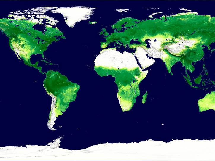
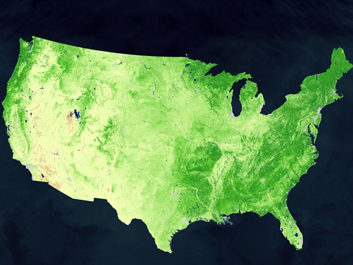
The Terra Moderate Resolution Imaging Spectroradiometer (MODIS) Vegetation Indices Monthly (MOD13A3) Version 6.1 data are provided monthly at 1 kilometer (km) spatial resolution as a gridded Level 3 product in the sinusoidal projection. In generating this monthly product, the algorithm ingests all the MOD13A2 products that overlap the month and employs a weighted temporal average.
The MODIS Normalized Difference Vegetation Index (NDVI) complements NOAA's Advanced Very High Resolution Radiometer (AVHRR) NDVI products and provides continuity for time series historical applications. MODIS also includes an Enhanced Vegetation Index (EVI) that minimizes canopy background variations and maintains sensitivity over dense vegetation conditions. The EVI uses the blue band to remove residual atmosphere contamination caused by smoke and sub-pixel thin clouds. The MODIS NDVI and EVI products are computed from surface reflectances corrected for molecular scattering, ozone absorption, and aerosols.
Vegetation indices are used for global monitoring of vegetation conditions and are used in products displaying land cover and land cover changes. These data may be used as input for modeling global biogeochemical and hydrologic processes as well as global and regional climate. Additional applications include characterizing land surface biophysical properties and processes, such as primary production and land cover conversion.
Provided along with the vegetation layers and the two quality assurance (QA) layers are reflectance bands 1 (red), 2 (near-infrared), 3 (blue), and 7 (mid-infrared), as well as three observation layers.
Known Issues
- For complete information about known issues please refer to the MODIS/VIIRS Land Quality Assessment website.
Version Description
Product Summary
Citation
Citation is critically important for dataset documentation and discovery. This dataset is openly shared, without restriction, in accordance with the EOSDIS Data Use and Citation Guidance.
Copy Citation
File Naming Convention
The file name begins with the Product Short Name (MOD13A3) followed by the Julian Date of Acquisition formatted as AYYYYDDD (A2025152), the Tile Identifier which is horizontal tile and vertical tile provided as hXXvYY (h01v11), the Version of the data collection (061), the Julian Date and Time of Production designated as YYYYDDDHHMMSS (2025195144044), and the Data Format (hdf).
Documents
USER'S GUIDE
ALGORITHM THEORETICAL BASIS DOCUMENT (ATBD)
PRODUCT QUALITY ASSESSMENT
SCIENCE DATA PRODUCT VALIDATION
Publications Citing This Dataset
| Title | Year Sort ascending | Author | Topic |
|---|---|---|---|
| Assessing plague risk across seven decades of environmental change in Inner Mongolia, China: An interpretable machine learning | Wang, Xiaoxu, Shang, Meng, Zhao, Chunchun, Sun, Yelin, Feng, Lianfang, Xia, Lianxu, Liu, Qiyong | Vegetation Index, Normalized Difference Vegetation Index (NDVI), Enhanced Vegetation Index (EVI) | |
| Advancing Urban Carbon Emission Downscaling to 1 km Resolution: A Deep LearningBased SocioEconomicEnvironmental ( SEE ) Framework |
Shen, Zehao, Feng, Yuning, Fraedrich, Klaus, Du, Mingyi | Vegetation Index, Normalized Difference Vegetation Index (NDVI), Enhanced Vegetation Index (EVI) | |
| An improved global database and model of plant available soil phosphorus | McDowell, Richard W., Noble, Alasdair D. L., Doscher, Crile, Helfenstein, Julian | Vegetation Index, Normalized Difference Vegetation Index (NDVI), Enhanced Vegetation Index (EVI), Canopy Characteristics, Evergreen Vegetation, Crown, Deciduous Vegetation, Leaf Characteristics, Vegetation Cover, Land Use/Land Cover Classification | |
| A global mountain long-term monthly mean air temperature dataset from priority-based weighted fusion of multi-source 1-km satellite LST products and in-situ observations | Zhao, Wei, Zhao, Junli, Xie, Xinyao, Wang, Yong, Yin, Gaofei, Yang, Yanqing, Wu, Jiujiang | Vegetation Index, Normalized Difference Vegetation Index (NDVI), Enhanced Vegetation Index (EVI) | |
| A Multi-City Assessment of Genomic Evolution in the Native Wildflower Impatiens capensis | Rivkin, L. Ruth, Garroway, Colin J., Johnson, Marc T. J. | Vegetation Index, Normalized Difference Vegetation Index (NDVI), Enhanced Vegetation Index (EVI) | |
| A Multi-Source Geospatial Framework for the Evaluation of Urban Flood Resilience Under Extreme Rainfall: Evidence from Chongqing, China | Yang, Tao, Yun, Yingxia, Tang, Fengliang, Zheng, Xiaolei | Vegetation Index, Normalized Difference Vegetation Index (NDVI), Enhanced Vegetation Index (EVI) | |
| Mapping the global development likelihood of wastewater treatment plants using a novel positive-unlabeled deep neural network | Li, Wenkai, Liu, Hongliang, Li, Mingxuan | Vegetation Index, Normalized Difference Vegetation Index (NDVI), Enhanced Vegetation Index (EVI), Canopy Characteristics, Evergreen Vegetation, Crown, Deciduous Vegetation, Leaf Characteristics, Vegetation Cover, Land Use/Land Cover Classification | |
| Mapping the local effectiveness of mass drug administration for malaria using transportability methods | Roh, Michelle E., Tong, Yanwei, Heitmann, Gabriella Barratt, Jia, Junran, Ba, El-hadji Konko Cire, Ndiaye, Jean Louis, Fogelson, Ari, Milligan, Paul, Seck, Amadou, Diallo, Abdoulaye, Lo, Aminata Colle, Baiocchi, Michael, Gosling, Roly, Bennett, Adam, Hsiang, Michelle S., Benjamin-Chung, Jade | Vegetation Index, Normalized Difference Vegetation Index (NDVI), Enhanced Vegetation Index (EVI), Emissivity, Land Surface Temperature | |
| Model-Based Data Integration Improves Species Distribution Models for | Makinen, Jussi, Cohen, Jeremy, Jetz, Walter | Vegetation Index, Normalized Difference Vegetation Index (NDVI), Enhanced Vegetation Index (EVI) | |
| Land Surface Temperature Shows Negligible Difference Between Inside and | Duan, Chunhui, Han, Cunbo, Hu, Wei, Liu, Jiawei, Ma, Yaoming | Albedo, Anisotropy, Vegetation Index, Normalized Difference Vegetation Index (NDVI), Enhanced Vegetation Index (EVI), Land Surface Temperature, Emissivity, Terrain Elevation, RADAR IMAGERY, Topographical Relief Maps | |
| Assessing the resilience of regional water resource systems: A case of the Hexi inland river basins, China | Zheng, Zhihan, Su, Bo, Wang-Erlandsson, Lan, Chen, Deliang, Yang, Liang Emlyn, Ai, Mei, Xiao, Cunde | Vegetation Index, Normalized Difference Vegetation Index (NDVI), Enhanced Vegetation Index (EVI) | |
| Associations between greenness change and mental distress prevalence change by housing tenure: An analysis of 109 U.S. metropolitan areas | Prasanth, Saira, Warren, Joshua L., Carrion, Daniel, Gonsalves, Gregg, Keene, Danya E. | Vegetation Index, Normalized Difference Vegetation Index (NDVI), Enhanced Vegetation Index (EVI) | |
| Distribution Characteristics and Hazard Assessment of Ground Collapse in the Mining Activity Areas of the TurpanHami Basin | Wang, Tao, Jin, Chao, Liang, Ning, Li, Yongchao, Song, Shuaihua, Ying, Jingjing, Zhao, Yiqing, Zheng, Bowen | Vegetation Index, Normalized Difference Vegetation Index (NDVI), Enhanced Vegetation Index (EVI) | |
| Estimating returns to surface-water management infrastructures: Evidence from coastal Bangladesh | Ahmed, Haseeb, Becerra-Valbuena, Luis, Czaplicka, Katarzyna, Daidone, Silvio, Parvez, Md. Shahnewaz, Roy, Ranjan, Sitko, Nicholas J., Vajja, Hari Prasad | Vegetation Index, Normalized Difference Vegetation Index (NDVI), Enhanced Vegetation Index (EVI) | |
| First highly pathogenic avian influenza outbreak in a commercial poultry | Cardenas, Nicolas C., Lopes, Francisco P.N., de Souza, Paulo A.S.C., Groff, Fernando H.S., Kowalski, Ananda P., Krein, Alessandra, Rigon, Grazziane, Etges, Rodrigo N., de Azevedo, Daniela L., Machado, Alencar, Maran, Vinicius, Machado, Felipe A., SEAPI-DDA, Machado, Gustavo | Vegetation Index, Normalized Difference Vegetation Index (NDVI), Enhanced Vegetation Index (EVI), Land Surface Temperature, Emissivity | |
| Frequent DryHot Extremes Slow the Loss of SemiArid Ecosystem Resilience | Shi, Guanghuan, Wei, Di, Qi, Mingliang, Zhang, Ziqi, Niu, Haolei, Zhang, Yun, Wang, Bo | Land Use/Land Cover Classification, Vegetation Index, Normalized Difference Vegetation Index (NDVI), Enhanced Vegetation Index (EVI), Photosynthesis, Primary Production, Vegetation Productivity | |
| Hybrid governance pathways driving western China's sustainable grassland transformation | Wang, Yue, Yang, Yongchun, Zhang, Wei | Vegetation Index, Normalized Difference Vegetation Index (NDVI), Enhanced Vegetation Index (EVI) | |
| Genetic recovery in an alpine climate-sensitive pika species during | Chu, Shi-jie, Liu, Ning, Feijo, Anderson, Wen, Zhi-xin, Ling, Ying-hui, Ge, De-yan | Vegetation Index, Normalized Difference Vegetation Index (NDVI), Enhanced Vegetation Index (EVI) | |
| Projecting the potential distribution of Setaria palmifolia in China in response to climate change | Xiang, Yangzhou, Li, Suhang, Liu, Ying, Yang, Qiong, Zhang, Jinxin, Yao, Bin, Li, Yuan | Vegetation Index, Normalized Difference Vegetation Index (NDVI), Enhanced Vegetation Index (EVI) | |
| The biogeography of soil and airborne fungi in the Southwestern USA in relation to climate and vegetation | Cat, Linh Anh, Gorris, Morgan E, Randerson, James T, Kivlin, Stephanie N, Treseder, Kathleen K | Vegetation Index, Normalized Difference Vegetation Index (NDVI), Enhanced Vegetation Index (EVI) | |
| Stability Amidst Change: A 12-Year Assessment of Sundarbans Mangrove Dynamics (20132024) | Oney, Md Rokib Udddin, Hoque, Md. Enamul | Vegetation Index, Normalized Difference Vegetation Index (NDVI), Enhanced Vegetation Index (EVI) | |
| Spatiotemporal distribution and driving factors of atmospheric pollutants in the U-Chang-Shi urban agglomeration, Northwestern China | Chen, Sheng, Li, Jinglong, He, Qing, Chen, Si, Ding, Gaixia, Dang, Zihao | Vegetation Index, Normalized Difference Vegetation Index (NDVI), Enhanced Vegetation Index (EVI) | |
| Revisiting the Urban Heat and Pollution Islands over the Kolkata Metropolitan Area, India | Pandey, Pragya, Tyagi, Bhishma, Kumar, Pradeep, Sahu, Saroj Kumar, Sharma, Kuldeep | Land Use/Land Cover Classification, Albedo, Anisotropy, Land Surface Temperature, Emissivity, Vegetation Index, Normalized Difference Vegetation Index (NDVI), Enhanced Vegetation Index (EVI) | |
| Unprecedented Amazonian rainforests damage during the 20232024 droughts | Bai, Hao, Liu, Xiangzhuo, Yang, Hui, Chave, Jerome, Ciais, Philippe, Wigneron, Jean-Pierre, Saatchi, Sassan, Xiao, Jingfeng, Le Toan, Thuy, Hu, Xiaomei, Yang, Ziyan, Wang, Lijun, Fan, Lei, Yao, Yitong, Chen, Xiuzhi, Liu, Yanxu, Xue, Baolin, Guo, Qinghua, Tang, Zhiyao, Liu, Hongyan, Fang, Jingyun, Tao, Shengli | Plant Phenology, Canopy Characteristics, Vegetation Cover, Lidar, Topography, Vegetation Height, Fire Ecology, Biomass Burning, Wildfires, Fire Occurrence, Burned Area, Vegetation Index, Normalized Difference Vegetation Index (NDVI), Enhanced Vegetation Index (EVI), Reflectance, Anisotropy | |
| Upslope and downslope vegetation expansions on the warming and wetting QinghaiTibet Plateau | Ji, Hailong, Nan, Zhuotong, Chen, Yuhong, Zhao, Shuping | Vegetation Index, Normalized Difference Vegetation Index (NDVI), Enhanced Vegetation Index (EVI) |
Variables
The table below lists the variables contained within a single granule for this dataset. Variables often contain observed or derived geophysical measurements collected from a variety of sources, including remote sensing instruments on satellite and airborne platforms, field campaigns, in situ measurements, and model outputs. The terms variable, parameter, scientific data set, layer, and band have been used across NASA’s Earth science disciplines; however, variable is the designated nomenclature in NASA’s Common Metadata Repository (CMR). Variable metadata attributes such as Name, Description, Units, Data Type, Fill Value, Valid Range, and Scale Factor allow users to efficiently process and analyze the data. The full range of attributes may not be applicable to all variables. Additional information on variable attributes is typically available in the data, user guide, and/or other product documentation.
For questions on a specific variable, please use the Earthdata Forum.
| Name Sort descending | Description | Units | Data Type | Fill Value | Valid Range | Scale Factor | Offset |
|---|---|---|---|---|---|---|---|
| 1 km monthly blue reflectance | Surface Reflectance Band 3 | N/A | int16 | -1000 | 0 to 10000 | 0.0001 | N/A |
| 1 km monthly EVI | 1 km monthly EVI | EVI | int16 | -3000 | -2000 to 10000 | 0.0001 | N/A |
| 1 km monthly MIR reflectance | Surface Reflectance Band 7 | N/A | int16 | -1000 | 0 to 10000 | 0.0001 | N/A |
| 1 km monthly NDVI | 1 km monthly NDVI | NDVI | int16 | -3000 | -2000 to 10000 | 0.0001 | N/A |
| 1 km monthly NIR reflectance | Surface Reflectance Band 2 | N/A | int16 | -1000 | 0 to 10000 | 0.0001 | N/A |
| 1 km monthly pixel reliability | Quality reliability of VI pixel | Rank | int8 | -1 | 0 to 3 | N/A | N/A |
| 1 km monthly red reflectance | Surface Reflectance Band 1 | N/A | int16 | -1000 | 0 to 10000 | 0.0001 | N/A |
| 1 km monthly relative azimuth angle | Relative azimuth angle of VI pixel | Degree | int16 | -4000 | -18000 to 18000 | 0.01 | N/A |
| 1 km monthly sun zenith angle | Sun zenith angle of VI pixel | Degree | int16 | -10000 | 0 to 18000 | 0.01 | N/A |
| 1 km monthly view zenith angle | View zenith angle of VI Pixel | Degree | int16 | -10000 | 0 to 18000 | 0.01 | N/A |
| 1 km monthly VI Quality | VI quality indicators | Bit Field | uint16 | 65535 | 0 to 65534 | N/A | N/A |