We are in the process of migrating all NASA Earth science data sites into Earthdata from now until end of 2026. Not all NASA Earth science data and resources will appear here until then. Thank you for your patience as we make this transition.
Read about the Web Unification Project
Land Surface News
Articles, resources, and announcements from Land Surface.

Image captured on Dec 24, 2021, by the OLI instrument aboard the Landsat 8 satellite.
Worldview Image of the Week
Jan. 26, 2022
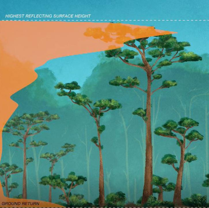
New dataset provides the first high-resolution 3D aboveground biomass density estimates for tropical and temperate forests around the globe.
Feature Article
Jan. 25, 2022
Synthetic aperture radar may give researchers an opportunity to study volcanoes in finer detail than ever before.
Data User Story
Jan. 23, 2022

Worldview now has temperature conversion and new tour stories, and GIBS is moving to the cloud!
Blog
Jan. 19, 2022

High-resolution Digital Elevation Models (DEM) for non-polar regions at two-meter spatial resolution are now available.
Feature Article
Dec. 7, 2021

Image captured on Nov 9, 2021, by the MSI instrument aboard ESA's Sentinel 2A and 2B satellites.
Worldview Image of the Week
Dec. 7, 2021
Image captured on November 22, 2021, by the MODIS instrument aboard NASA's Aqua satellite.
Worldview Image of the Week
Dec. 7, 2021

Satellites provide crucial information for researchers to monitor and help improve agricultural productivity in India.
Feature Article
Oct. 22, 2021
SHOWING 8 OF 285