
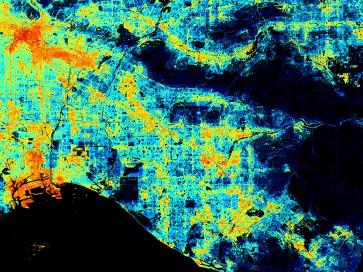
Albedo Data Access and Tools

From discovery to visualization, data tools such as the Clouds and the Earth's Radiant Energy System (CERES) Subset/Visualization Tool, Earthdata Search, and Worldview guide users in making the most of albedo data.

Albedo Datasets

Dataset Sort descending Version Platforms Instruments Temporal Extent Spatial Extent Spatial Resolution Data Format
CERES and GEO-Enhanced TOA, Within-Atmosphere and Surface Fluxes, Clouds and Aerosols 1-Hourly Terra-NOAA20 Edition4A Edition4A GEOSTATIONARY SATELLITES, Terra, NOAA-20 IMAGING RADIOMETERS, CERES-FM1, CERES-FM2, CERES SCANNER, MODIS, CERES-FM6, VIIRS 2022-04-01 to Present HDF4
CERES and GEO-Enhanced TOA, Within-Atmosphere and Surface Fluxes, Clouds and Aerosols 3-Hourly Terra Edition4A Edition4A GEOSTATIONARY SATELLITES, Terra IMAGING RADIOMETERS, CERES-FM1, CERES SCANNER, CERES-FM2, MODIS 2000-03-01 to 2002-06-30 HDF4
CERES and GEO-Enhanced TOA, Within-Atmosphere and Surface Fluxes, Clouds and Aerosols 3-Hourly Terra-Aqua Edition4A Edition4A GEOSTATIONARY SATELLITES, Terra, AQUA IMAGING RADIOMETERS, CERES-FM1, CERES-FM2, CERES SCANNER, MODIS, CERES-FM4, CERES-FM3 2002-07-01 to Present HDF4
CERES and GEO-Enhanced TOA, Within-Atmosphere and Surface Fluxes, Clouds and Aerosols Daily Terra-Aqua Edition4A Edition4A GEOSTATIONARY SATELLITES, Terra, AQUA IMAGING RADIOMETERS, CERES-FM1, CERES-FM2, CERES SCANNER, MODIS, CERES-FM4, CERES-FM3 2002-07-01 HDF4
CERES and GEO-Enhanced TOA, Within-Atmosphere and Surface Fluxes, Clouds and Aerosols Daily Terra-Aqua-NOAA20 Edition4B Edition4B GEOSTATIONARY SATELLITES, Terra, NOAA-20, AQUA IMAGING RADIOMETERS, CERES-FM1, CERES-FM2, CERES SCANNER, MODIS, CERES-FM6, VIIRS, CERES-FM3, CERES-FM4 2000-03-01 to Present HDF4
CERES and GEO-Enhanced TOA, Within-Atmosphere and Surface Fluxes, Clouds and Aerosols Daily Terra-NOAA20 Edition4A Edition4A GEOSTATIONARY SATELLITES, Terra, NOAA-20 IMAGING RADIOMETERS, CERES-FM1, CERES-FM2, CERES SCANNER, MODIS, CERES-FM6, VIIRS 2022-04-01 HDF4
CERES and GEO-Enhanced TOA, Within-Atmosphere and Surface Fluxes, Clouds and Aerosols Daily Terra-NPP Edition1A Edition1A GEOSTATIONARY SATELLITES, Terra, Suomi-NPP IMAGING RADIOMETERS, CERES-FM1, CERES-FM2, CERES SCANNER, MODIS, CERES-FM5, VIIRS 2012-02-01 to 2017-11-30 HDF4
CERES and GEO-Enhanced TOA, Within-Atmosphere and Surface Fluxes, Clouds and Aerosols Monthly Terra-Aqua Edition4A Edition4A GEOSTATIONARY SATELLITES, Terra, AQUA IMAGING RADIOMETERS, CERES-FM1, CERES-FM2, CERES SCANNER, MODIS, CERES-FM3, CERES-FM4 2002-07-01 to Present HDF4
CERES and GEO-Enhanced TOA, Within-Atmosphere and Surface Fluxes, Clouds and Aerosols Monthly Terra-Aqua-NOAA20 Edition4B Edition4B GEOSTATIONARY SATELLITES, Terra, NOAA-20, AQUA IMAGING RADIOMETERS, CERES-FM1, CERES-FM2, CERES SCANNER, MODIS, CERES-FM6, VIIRS, CERES-FM3, CERES-FM4 2000-03-01 to Present HDF4
CERES and GEO-Enhanced TOA, Within-Atmosphere and Surface Fluxes, Clouds and Aerosols Monthly Terra-NOAA20 Edition4A Edition4A GEOSTATIONARY SATELLITES, Terra, NOAA-20 IMAGING RADIOMETERS, CERES-FM1, CERES-FM2, CERES SCANNER, MODIS, CERES-FM6, VIIRS 2022-04-01 to Present HDF4
SHOWING 10 OF 737

Albedo Data Tools

No Results

Frequently Asked Questions

Earthdata Forum

Our online forum provides a space for users to browse thousands of FAQs about research needs, data, and data applications. You can also submit new questions for our experts to answer.

Submit Questions to Earthdata Forumand View Expert Responses

Earthdata
Forum