We are in the process of migrating all NASA Earth science data sites into Earthdata from now until end of 2026. Not all NASA Earth science data and resources will appear here until then. Thank you for your patience as we make this transition.
Read about the Web Unification Project
Precipitation News
Articles, resources, and announcements from Precipitation.

Precipitation Rate on 5 July 2020 from IMERG.
Worldview Image of the Week
Nov. 4, 2020

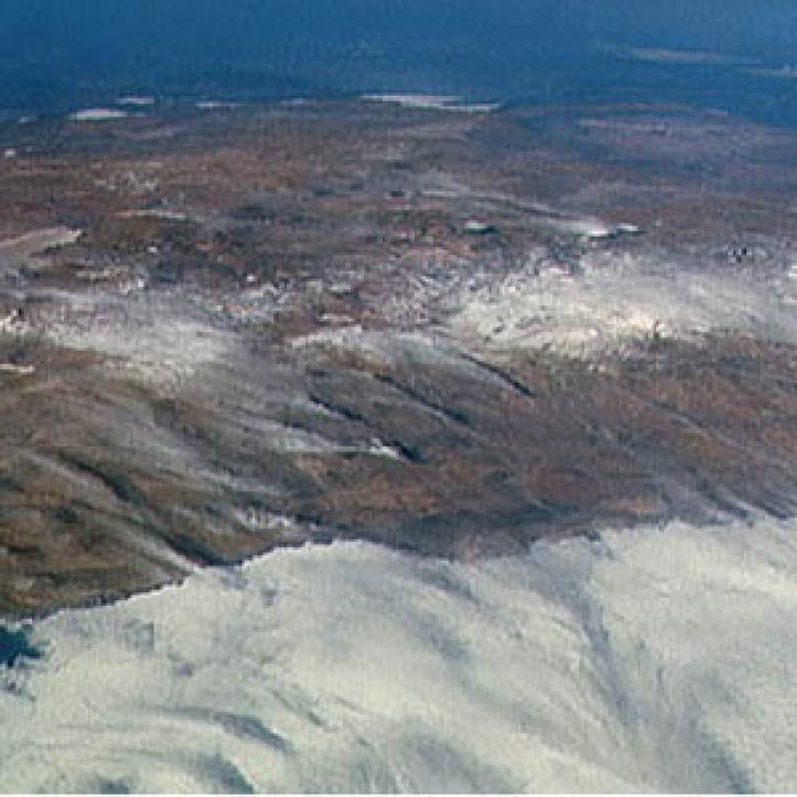
Image captured by the MODIS and AMSR2 instruments, aboard the Aqua and GCOM-W1 satellites, on 30 August 2015.
Worldview Image of the Week
Sept. 11, 2020

A new long-term archive of satellite data will help hydrologists monitor floods, allow aid agencies to pinpoint flood-prone regions, and provide information for modeling Earth's complex hydrologic cycles.
Feature Article
July 28, 2020
For more than 400 years, Andean mountain people in Peru and Bolivia have forecasted the most auspicious time to plant potatoes by stargazing.
Feature Article
July 28, 2020

Scientists use Landsat satellite images from LP DAAC to study a hantavirus outbreak.
Feature Article
July 22, 2020
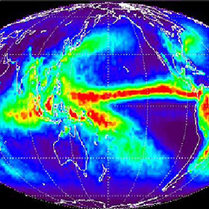
Overview of methodology to monitor rainfall on a global scale.
Feature Article
July 21, 2020
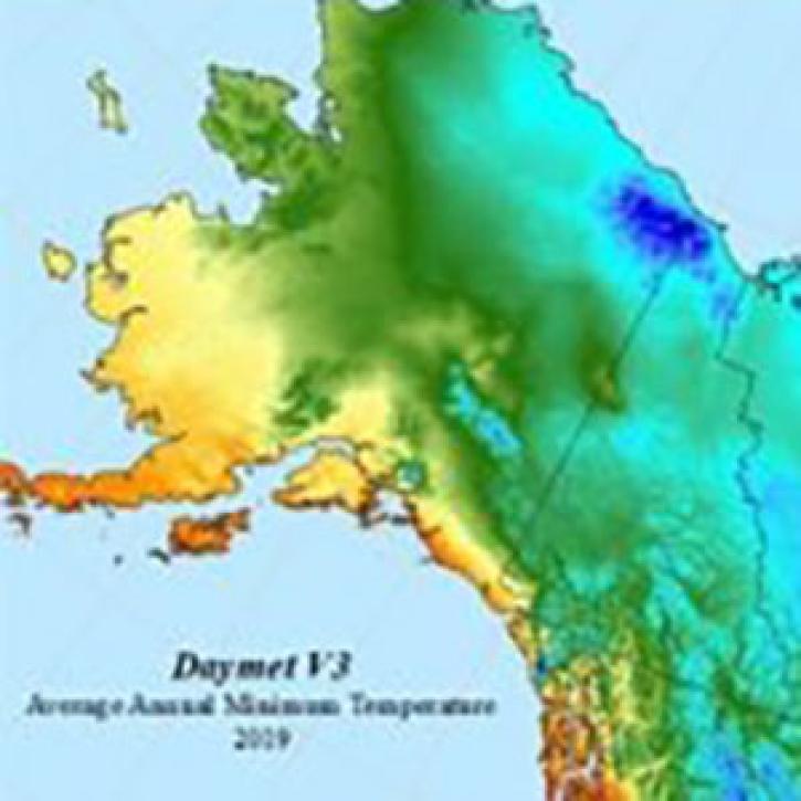
The Daymet data collection at NASA's ORNL DAAC provides daily meteorological data for the entire North American continent spanning 1980 to 2019 (and counting).
Feature Article
July 13, 2020

Image captured on 22 October 2017, by the VIIRS instrument, aboard the joint NASA/NOAA Suomi NPP satellite.
Worldview Image of the Week
Feb. 26, 2020
SHOWING 8 OF 50