We are in the process of migrating all NASA Earth science data sites into Earthdata from now until end of 2026. Not all NASA Earth science data and resources will appear here until then. Thank you for your patience as we make this transition.
Read about the Web Unification Project
Dust/Ash/Smoke News
Articles, resources, and announcements from Dust/Ash/Smoke.
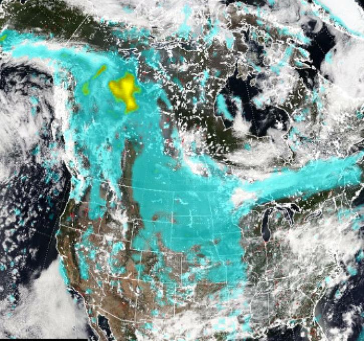
Pyrocumulonimbus (pyroCb) events (fire thunderstorms) caused by wildfires in western Canada were detected by the Ozone Mapping and Profiler Suite (OMPS) instrument July 19-24, 2024.
News
July 30, 2024

Image captured on July 17, 2024, by the VIIRS instrument aboard the joint NASA/NOAA NOAA-20 satellite.
Worldview Image of the Week
July 18, 2024
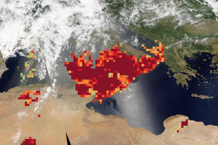
Image captured on June 20, 2024, by the MODIS and AIRS instruments aboard NASA's Aqua satellite.
Worldview Image of the Week
June 20, 2024

Base true-color corrected reflectance image acquired by the VIIRS instrument aboard the joint NASA/NOAA Suomi NPP satellite on May 21, 2024, overlaid with the Fires and Thermal Anomalies and Aerosol Index layers.
Worldview Image of the Week
May 23, 2024
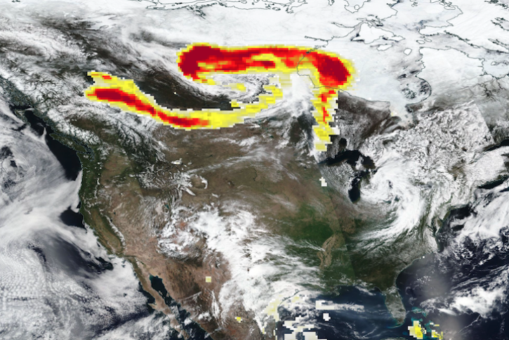
Base corrected reflectance image acquired May 11, 2024, by the VIIRS instrument aboard the joint NASA/NOAA Suomi NPP satellite and overlaid with Aerosol Index values from the OMPS instrument.
Worldview Image of the Week
May 16, 2024

Image captured on Apr 24, 2024, by the VIIRS instrument aboard the joint NASA/NOAA NOAA-20 satellite.
Worldview Image of the Week
April 25, 2024

NASA has long used imaging spectroscopy to peer into space. Now, scientists are using the technology to take a closer look at Earth.
Data User Story
Feb. 15, 2024

Dust is a major hazard, and it is imperative that societies are prepared for the onset of these storms to minimize economic loss and save lives.
Blog
Dec. 7, 2023
SHOWING 8 OF 205