We are in the process of migrating all NASA Earth science data sites into Earthdata from now until end of 2026. Not all NASA Earth science data and resources will appear here until then. Thank you for your patience as we make this transition.
Read about the Web Unification Project
Aerosols News
Articles, resources, and announcements from Aerosols.
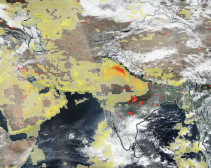
Image captured Nov 1, 2021, by the VIIRS instrument aboard the joint NASA/NOAA Suomi NPP satellite.
Worldview Image of the Week
Dec. 7, 2021

Image captured on Aug 16, 2021, by the MODIS instrument aboard NASA's Terra satellite.
Worldview Image of the Week
Nov. 1, 2021

Image captured on Oct 3, 2021, by the MODIS instrument aboard the Aqua satellite.
Worldview Image of the Week
Oct. 28, 2021

Image captured on Aug 22, 2021, by the VIIRS instrument, aboard the joint NASA/NOAA NOAA 20 satellite.
Worldview Image of the Week
Oct. 22, 2021

Image captured on Sep 12, 2021, by the MODIS instrument aboard the Aqua satellite.
Worldview Image of the Week
Oct. 20, 2021

Data available from NASA’s LP DAAC helps scientists like Dr. Robert Wright develop systems for autonomously detecting volcanic eruptions from space.
Data User Story
Oct. 20, 2021

View smoke in FIRMS using Corrected Reflectance Imagery or aerosol indices.
Blog
July 15, 2021

Based on the same MODIS algorithm, the new VIIRS Dark Target Aerosol product provides global satellite-derived measurements of Aerosol Optical Depth and aerosol properties over land and ocean.
News
July 12, 2021
SHOWING 8 OF 250