We are in the process of migrating all NASA Earth science data sites into Earthdata from now until end of 2026. Not all NASA Earth science data and resources will appear here until then. Thank you for your patience as we make this transition.
Read about the Web Unification Project
Filters

NASA Earth science data help scientists like Dr. Dan Runfola estimate the socioeconomic status of individuals around the globe.
Data User Story
July 27, 2023

The Open Geospatial Consortium (OGC) is building a collaborative open science environment called the Open Science Persistent Demonstrator (OSPD) and wants your help. Learn how you can be involved in this global, multi-agency effort.
News
July 26, 2023

New SAGE III/ISS Quicklook and Expedited Data Portal
News
July 26, 2023

Image captured July 19, 2023, by the VIIRS instrument aboard the joint NASA/NOAA NOAA-20 satellite.
Worldview Image of the Week
July 20, 2023
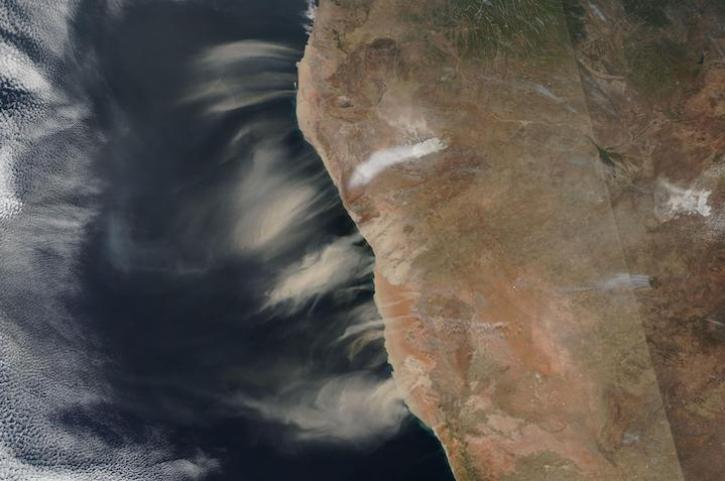
Image captured July 11, 2023, by the VIIRS instrument aboard the joint NASA/NOAA Suomi NPP satellite.
Worldview Image of the Week
July 13, 2023
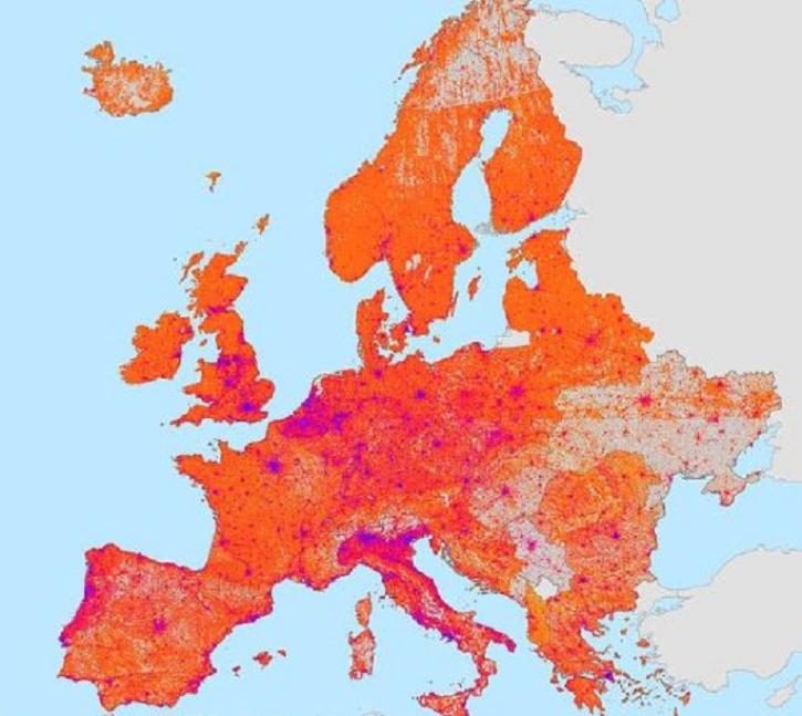
The Global Gridded Relative Deprivation Index is the first product of its kind to cover the world at a 1-kilometer resolution.
Feature Article
July 13, 2023

The participation by NASA's Physical Oceanography Distributed Active Archive Center (PO.DAAC) in the Earthdata Forum gives users the chance to communicate with and learn from physical oceanography experts.
News
July 12, 2023
CASEI is the most extensive search and discovery interface for information about NASA airborne and field campaigns.
News
July 12, 2023
SHOWING 8 OF 2379