We are in the process of migrating all NASA Earth science data sites into Earthdata from now until end of 2026. Not all NASA Earth science data and resources will appear here until then. Thank you for your patience as we make this transition.
Read about the Web Unification Project
Filters

A summary of datasets, products, and resources released by NASA's Distributed Active Archive Centers (DAACs) in May 2024.
News
June 6, 2024

A NASA-funded effort created a way to streamline access to NASA cloud-based data for users working in the R programming language.
News
June 5, 2024
New carbon dioxide and methane data, expanded spatial and temporal resolution for several datasets, and an enhanced data exploration environment are some of the updates in this beta release.
News
June 4, 2024
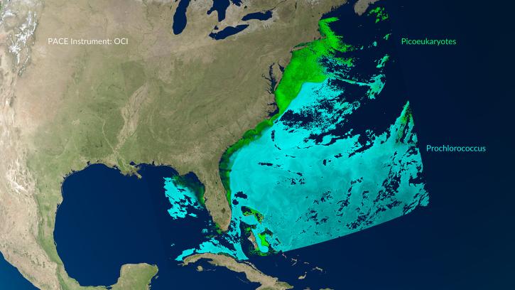
A series of Jupyter notebook tutorials show how to retrieve and use data from NASA's Plankton, Aerosol, Cloud, ocean Ecosystem (PACE) mission.
News
May 31, 2024
Learn how to access and visualize NASA's Advanced Microwave Scanning Radiometer HDF-EOS5 Point product in Python via OPeNDAP.
Data Recipe
May 31, 2024

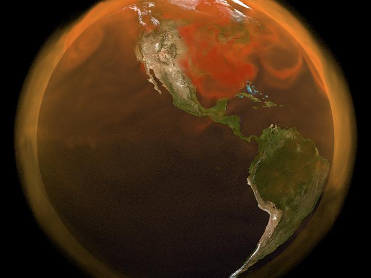
GHRSST Sea Surface Temperature image showing the Gulf Stream in the Atlantic Ocean on May 29, 2024.
Worldview Image of the Week
May 30, 2024
The beta release of Tropospheric Emissions: Monitoring of Pollution (TEMPO) mission data products lets users begin developing applications using these data.
News
May 30, 2024

The AGU Fall Meeting is your chance to learn the latest information about NASA Earth observation data, missions, and science.
Blog
May 30, 2024
SHOWING 8 OF 2379