We are in the process of migrating all NASA Earth science data sites into Earthdata from now until end of 2026. Not all NASA Earth science data and resources will appear here until then. Thank you for your patience as we make this transition.
Read about the Web Unification Project
Filters

ESDS program elements AGU sessions, posters, e-lightning talks and workshops for the Virtual Fall AGU 2020.
Feature Article
Dec. 1, 2020
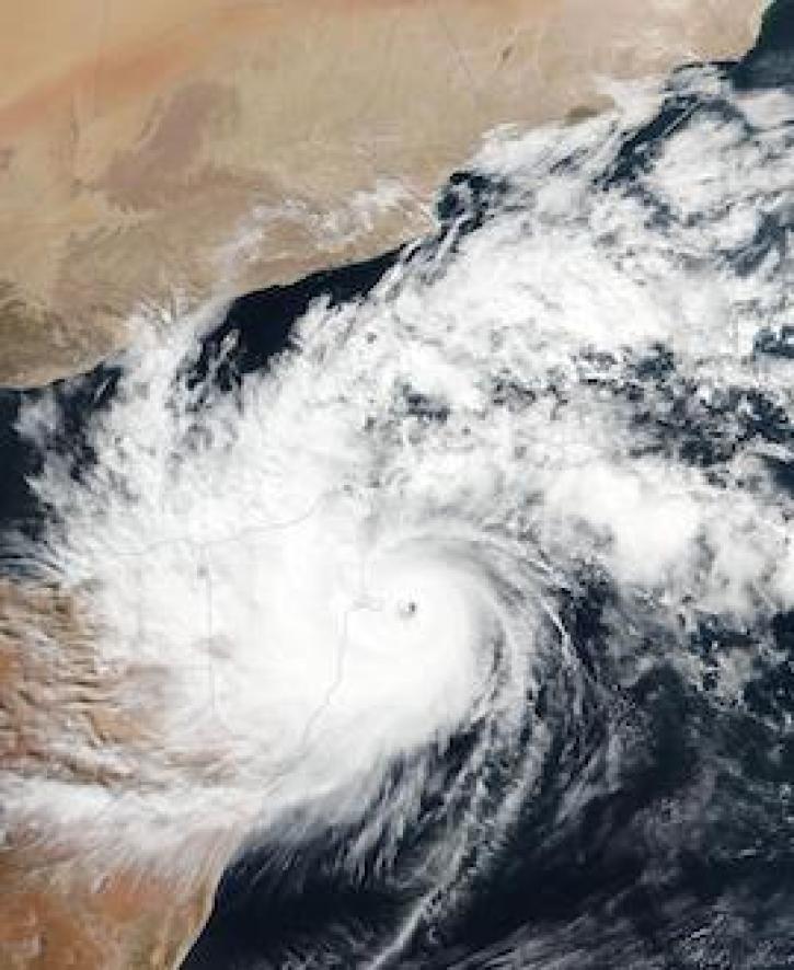
Image captured on 22 November 2020, by the VIIRS instrument, aboard the joint NASA/NOAA Suomi NPP satellite.
Worldview Image of the Week
Nov. 30, 2020

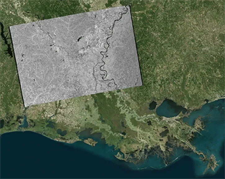
Discover how LP DAAC data supports long-term vegetation trend analysis in East Africa and live fuel moisture estimation in fire-prone shrublands of Spain.
Data in Action
Nov. 30, 2020

Image captured on 15 November 2020, by the VIIRS instrument, aboard the joint NASA/NOAA NOAA-20 satellite.
Worldview Image of the Week
Nov. 23, 2020
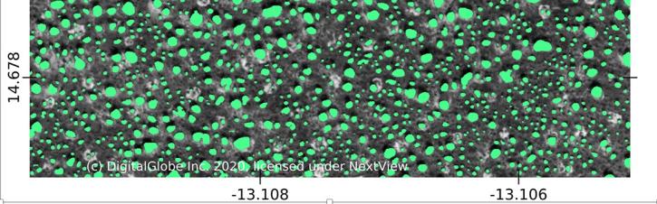
Using commercial satellite data and machine learning, scientists discovered a surprisingly large number of trees in Africa's drylands.
Feature Article
Nov. 19, 2020

Charting global mean sea level rise since 1900.
Data in Action
Nov. 19, 2020
Each year, scientists highlight the many applications of geographic information systems (GIS) on GIS Day.
News
Nov. 19, 2020

A new article authored by members of NASA's Earth Science Data Systems program and the Radiant Earth Foundation was published in the American Geophysical Union's Eos.
Feature Article
Nov. 17, 2020
SHOWING 8 OF 2379