We are in the process of migrating all NASA Earth science data sites into Earthdata from now until end of 2026. Not all NASA Earth science data and resources will appear here until then. Thank you for your patience as we make this transition.
Read about the Web Unification Project
Filters

Knowing how users will interact with EOSDIS data in the cloud ensures a more efficient cloud evolution and a cloud architecture that best facilitates data access and use.
Feature Article
Feb. 25, 2021

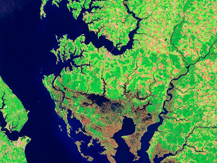
Image captured on 5 February 2021, by the MSI instrument, aboard ESA's Sentinel 2A and 2B satellites.
Worldview Image of the Week
Feb. 22, 2021

The User Working Group provides guidance on user needs and priorities related to human dimensions data and associated tools and services.
News
Feb. 9, 2021

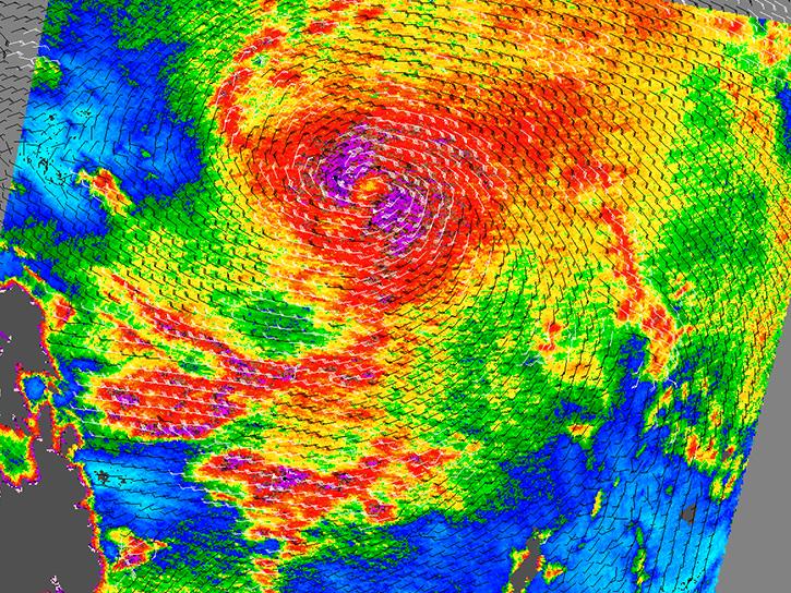
Image captured on 31 January 2021, by the VIIRS instrument, aboard the joint NASA/NOAA Suomi NPP satellite.
Worldview Image of the Week
Feb. 8, 2021

Access Sentinel-1 GAMMA Interferometric synthetic aperture radar (InSAR) and radiometrically terrain-corrected (RTC) products via Vertex.
News
Feb. 6, 2021

Access videos and slides about several topics on cloud computing.
Tutorial
Feb. 6, 2021
Data from NASA's Socioeconomic Data and Applications Center were used to create interactive maps included in the exhibit.
News
Feb. 5, 2021
Active instruments emit energy and collect data based on changes in the return signal.
Data Basics
Feb. 1, 2021
SHOWING 8 OF 2379