Delivery of Suomi National Polar-orbiting Partnership (Suomi NPP) satellite data products will cease on November 1, 2026. Data users should transition now to alternative products from NOAA-21 and NOAA-20.
Suomi NPP data announcement
Tropical Storm Zeta Near Honduras
Image captured on 25 October 2020, by the VIIRS instrument, aboard the joint NASA/NOAA Suomi NPP satellite.
Image
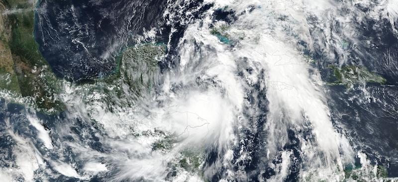
Image of Tropical Storm Zeta near Honduras, acquired on 25 October 2020. Weather forecasters expect the storm to strengthen into a hurricane and will affect the Yucatan Peninsula, Mexico by Monday afternoon or evening and make landfall on southeastern Louisiana, USA by Wednesday afternoon or evening. The photo-like, true color corrected reflectance image was captured by the Visible Infrared Imaging Radiometer Suite (VIIRS), aboard the joint NASA/NOAA Suomi NPP satellite.
Visit Worldview to visualize near real-time imagery from NASA's EOSDIS, and check out more Worldview weekly images in our archive.
References: Gulf Coast Braces As Tropical Storm Zeta Poised To Become A Hurricane
Details
Last Updated
Published on
Nov. 2, 2020