We are in the process of migrating all NASA Earth science data sites into Earthdata from now until end of 2026. Not all NASA Earth science data and resources will appear here until then. Thank you for your patience as we make this transition.
Read about the Web Unification Project
Filters

NASA’s Earth Science Data and Information System (ESDIS) Project prepared for users’ needs during cloud migration by providing analysis-ready data, modeling data egress, and providing resources for cloud computing.
Feature Article
Feb. 25, 2021

The upcoming NISAR satellite mission is expected to add as much as 85 TB of data each day to the EOSDIS archive. The commercial cloud is being explored as a way to archive and disseminate this extremely high volume of data efficiently.
Feature Article
Feb. 25, 2021
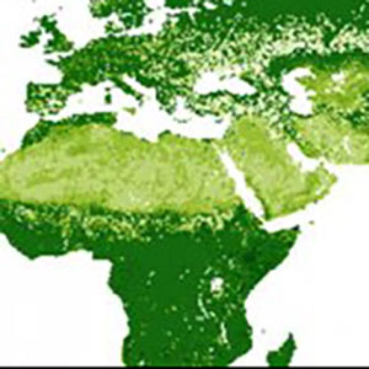
New maps combine remotely sensed biomass data for different land cover types into harmonized global maps of above and belowground biomass.
Feature Article
Feb. 25, 2021

Invasive species cost the U.S. economy approximately $120 billion a year and disrupt the dynamics of ecosystems. Researchers are increasingly using remote sensing to map where invasive species are and where they could spread in order to minimize their damage.
Feature Article
Feb. 25, 2021

Knowing how users will interact with EOSDIS data in the cloud ensures a more efficient cloud evolution and a cloud architecture that best facilitates data access and use.
Feature Article
Feb. 25, 2021

Daymet Version 4's improved algorithm and reduced timing and sensor biases result in more accurate and precise data.
Feature Article
Jan. 29, 2021


A new generation reconnects with greener pastures.
Feature Article
Dec. 28, 2020
SHOWING 8 OF 534