During the Spring 2017 term of NASA’s DEVELOP National Program, participants used geospatial data and technologies to analyze several land use and environmental applications across the world. Each project completed by a DEVELOP team is conducted in partnership with state and federal agencies or organizations local to the study area.  Fundamental to the analytical and geospatial component of each of these projects is NASA Earth science remote sensing data. Many of these projects use data collected by the Moderate Resolution Imaging Spectroradiometer (MODIS) sensor onboard NASA’s Terra and Aqua platforms, the Terra Advanced Spaceborne Thermal Emission and Reflection Radiometer (ASTER), and derived data from NASA’s Shuttle Radar Topography Mission (SRTM), all data that are distributed by NASA's Land Processes Distributed Active Archive Center (LP DAAC).

All projects conducted in the Spring 2017 term, as well as in past terms, can be found in the DEVELOP archive.

One of the projects, Beating the Heat: Assessing Extreme Temperatures of Public Transit, used NASA Earth observation data to study land surface temperature and vegetation presence along bus transit stops during the extremely hot summers in Phoenix, Arizona. Summer air temperatures in Phoenix often exceed 106°F (42.1°C), which can lead to heat-related illnesses in the community. This is of concern for residents who spend time outside waiting at bus stops as they are at a particular risk of heat stroke and heat exhaustion. Currently, the Phoenix Transit Department decides where to improve shade structures based on the number of riders who use the bus stops and the status of existing shelters.
Image
Image Caption

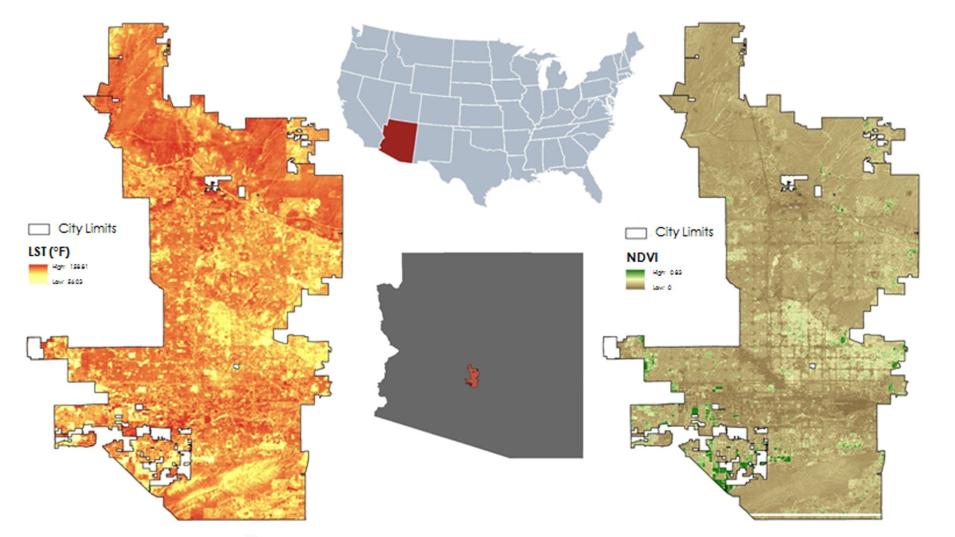
The image above shows the project’s study area along with Terra ASTER Land Surface Temperature and Landsat NDVI. Credit: Phoenix Health & Air Quality Team

Instruments and Techniques Used

Land surface temperature data from NASA’s Terra ASTER satellite sensor (AST_08) and Landsat 5 and 8 were used to determine which bus stops were the hottest over a 10-year period. In addition, the DEVELOP team also used Landsat 8 imagery to determine which bus stops had a presence of vegetation, which can aid in cooling the area. 

Major Findings

Maps created from this project were provided to the Phoenix Transit Department to aid in assessing which of the 4,000 bus stops could benefit from structures that provide relief from the heat. Efforts from this project can aid in reducing the risk of heat-related illnesses for the bus-riding population.

About the NASA DEVELOP National Program

The DEVELOP National Program is part of NASA’s Applied Sciences Program. Participants from around the country join the DEVELOP program for 10-week terms to apply data acquired by NASA Earth observing satellites to bridge the gap between science and society. DEVELOP participants work with local, state, and federal partners to create maps and other products in eight focus areas, including Agriculture & Food Security, Disasters, Ecological Forecasting, Energy, Health & Air Quality, Urban Development, Water Resources, and Transportation & Infrastructure.
 
Any use of trade, firm, or product names is for descriptive purposes only and does not imply endorsement by the U.S. Government.

Publication Reference

Dunbarr, T., Murphee, M., and Watkins, L., 2017, Beating the heat—Assessing extreme temperatures of public transit, accessed November 29, 2017.

Details

Last Updated

June 13, 2025

Published

Dec. 27, 2017

Data Center/Project

Land Processes DAAC (LP DAAC)