We are in the process of migrating all NASA Earth science data sites into Earthdata from now until end of 2026. Not all NASA Earth science data and resources will appear here until then. Thank you for your patience as we make this transition.
Read about the Web Unification Project
SWOT Resources
Documents
| Name Sort descending | Description | File Type | Date Published | |
|---|---|---|---|---|
| SWOT Project Release Note - Beta Pre-Validated KaRIn Products | SWOT Project Release Note - Beta Pre-Validated KaRIn Products | PDF (329.55 kb) | Nov. 30, 2023 |
SHOWING 1 OF 6
SWOT Learning Resources

Our Earth Data Officer, Katie Baynes, spoke at the Federal GIS Conference Plenary. In case you missed her presentation, here is a story map for you to catch up on how NASA Earth data can be leveraged in your GIS project.
StoryMap
March 5, 2025

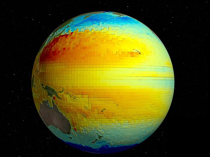
SWOT presents opportunities and challenges in characterizing sea surface height anomalies.
Data in Action
March 14, 2024

Learn how to discover, access, and use Surface Water and Ocean Topography (SWOT) mission data and how these data can lead to new, innovative science and applications in the world of water.
Webinar
March 6, 2024

SWOT data reveals the topography of the ocean surface at finer scales than ever before.
Data in Action
Dec. 7, 2023

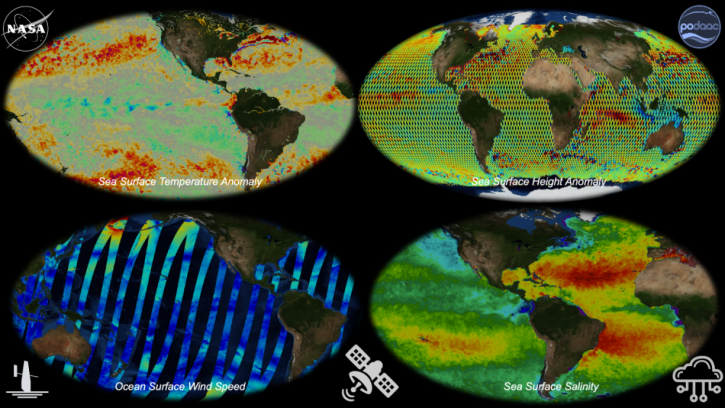
SWOT provides high-resolution data to help researchers monitor the vertical transport of heat and carbon within the ocean.
Data in Action
Sept. 15, 2023

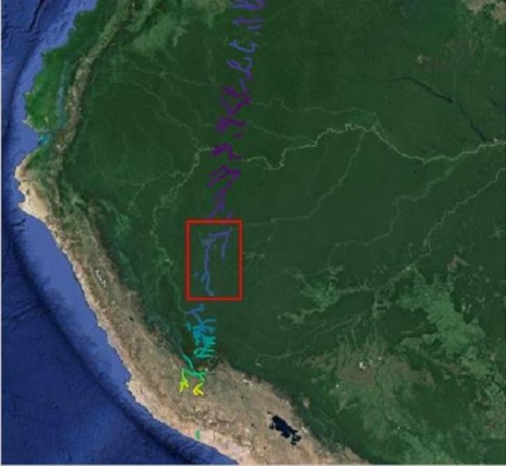
The Surface Water and Ocean Topography (SWOT) mission will provide the first-ever full view of Earth's freshwater bodies from space.
Data in Action
Dec. 12, 2022
SWOT and ECCO can measure sea surface height at different resolutions for monitoring the ocean's vertical heat, carbon transport, and other processes.
Data in Action
Nov. 2, 2022
Join us to learn about NASA's archive for physical oceanography data in the context of Open Science. We'll provide you with an introduction to remote sensing and in situ products at PO.DAAC and show you how to work with these data in the cloud.
Webinar
April 22, 2021
SHOWING 8 OF 18
SWOT News
View All News
Filters

Hydrocron, an API for time series retrievals of hydrology data products from the Surface Water and Ocean Topography (SWOT) mission, is now available.
News
Oct. 22, 2024

The SWOT On-Demand Level 2 Raster Generation System (SWODLR) for Surface Water and Ocean Topography (SWOT) data is now part of Earthdata Search.
News
Oct. 9, 2024

Hydrocron enables users to receive all Surface Water and Ocean Topography (SWOT) observations for a specific river ID within a specified date range.
News
Aug. 27, 2024

Validated science data products from the Surface Water and Ocean Topography (SWOT) mission are available through NASA Earthdata Search.
News
Aug. 14, 2024

A summary of datasets, products, and resources released by NASA's Distributed Active Archive Centers (DAACs) in July 2024.
News
Aug. 6, 2024

A summary of datasets, products, and resources released by NASA's Distributed Active Archive Centers (DAACs) in May 2024.
News
June 6, 2024
The Surface Water and Ocean Topography (SWOT) mission provides critical data for understanding Earth's water cycle, including data about freshwater systems that have not been available from any previous hydrology-related missions.
Data User Story
May 15, 2024

A summary of datasets, products, and resources released by NASA's Distributed Active Archive Centers (DAACs) in April 2024.
News
May 7, 2024
SHOWING 8 OF 28
Frequently Asked Questions
Earthdata Forum
Our online forum provides a space for users to browse thousands of FAQs about research needs, data, and data applications. You can also submit new questions for our experts to answer.
Submit Questions to Earthdata Forumand View Expert Responses