We are in the process of migrating all NASA Earth science data sites into Earthdata from now until end of 2026. Not all NASA Earth science data and resources will appear here until then. Thank you for your patience as we make this transition.
Read about the Web Unification Project
Aqua Resources
Earthdata resources for users working with NASA’s Aqua data include tutorials and other learning resources, news announcements such as instrument updates and data releases, user guides and related documents, and frequently asked questions.
Aqua Learning Resources

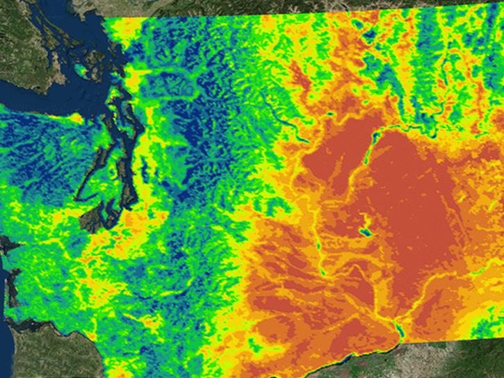
Learn how MODIS data were used to update the 1992 Montana Climate Atlas to better understand the state's climate and how it relates to resources and industries.
Data in Action
Oct. 21, 2015

Discover how MODIS data help track changes in snow water equivalents in the Sierra Nevada Mountains to help forecast drought in California.
Data in Action
Sept. 30, 2015

Discover how researchers used NASA remote sensing data to analyze the eruption of Calbuco Volcano and its impact on the surrounding environment.
Data in Action
May 29, 2015

This ARSET training focuses on regional and global observation resources for conservation management.
Training
May 5 - June 2, 2015

Read stories from the 2014 issue of Sensing our Planet to learn about the many uses of MODIS data distributed by LP DAAC.
Data in Action
March 18, 2015

MODIS data captured the extensive flooding of the Shire River in Malawi and Mozambique, caused by unusually heavy rains and a tropical cyclone.
Data in Action
Feb. 15, 2015
NASA's Northwest U.S. Agriculture Team used MODIS data to calculate the growing degree days of the codling moth.
Data in Action
Feb. 14, 2015

Learn how MODIS vegetation indices can be used to monitor variations in global vegetation conditions, such as seasonal leaf changes.
Data in Action
Dec. 23, 2014
SHOWING 8 OF 184
Aqua News
View All News
Filters

NASA near real-time Earth observing data are vital to emergency response. Dave Jones enables these data to be used collaboratively in real time across platforms by emergency responders and managers.
Data User Story
March 1, 2021

New VIIRS imagery from NOAA-20 along with new ways to evaluate and select imagery layers make NASA Worldview more useful than ever.
Feature Article
March 1, 2021
NASA's Level-1 and Atmosphere Archive and Distribution System Distributed Active Archive Center has joined the Earthdata Forum, NASA's interactive platform that gives data users the chance to communicate with and learn from experts.
News
March 1, 2021

Invasive species cost the U.S. economy approximately $120 billion a year and disrupt the dynamics of ecosystems. Researchers are increasingly using remote sensing to map where invasive species are and where they could spread in order to minimize their damage.
Feature Article
Feb. 25, 2021

Deforestation is taking a toll on the Amazon and other areas of high variability of life. Dr. Eric Bullock uses NASA Earth observation data to explore the consequences of land use and land cover change in these areas.
Data User Story
Feb. 25, 2021

Coastal ecosystems are some of Earth’s most biologically varied environments, especially coastal mangrove forests. Dr. Lagomasino uses Earth observing data to study these vital biomes.
Data User Story
Feb. 25, 2021

The webinar introduces satellite remote sensing, radiance conversion, image classification, and geophysical product creation, and more.
Webinar
Jan. 29, 2021
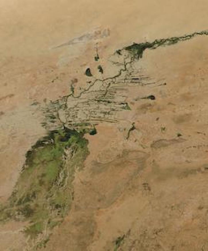
Image captured on 3 January 2021, by the MODIS instrument, aboard the Aqua satellite.
Worldview Image of the Week
Jan. 11, 2021
SHOWING 8 OF 356
Frequently Asked Questions
Earthdata Forum
Our online forum provides a space for users to browse thousands of FAQs about research needs, data, and data applications. You can also submit new questions for our experts to answer.
Submit Questions to Earthdata Forumand View Expert Responses