We are in the process of migrating all NASA Earth science data sites into Earthdata from now until end of 2026. Not all NASA Earth science data and resources will appear here until then. Thank you for your patience as we make this transition.
Read about the Web Unification Project
Aqua Resources
Earthdata resources for users working with NASA’s Aqua data include tutorials and other learning resources, news announcements such as instrument updates and data releases, user guides and related documents, and frequently asked questions.
Aqua Learning Resources

This ARSET training focuses on the use of remote sensing to understand global phenology.
Training
June 30 - July 14, 2020

Researchers used MODIS land cover products and ASTER models to identify suitable areas where an endangered species of monkey may reside.
Data in Action
June 29, 2020

Learn how a NASA DEVELOP team helped create models to determine an ideal location for a jaguar corridor using NASA Earth observation data.
Data in Action
May 21, 2020

This ARSET training addresses how to use remote sensing data for agriculture monitoring, specifically drought and crop monitoring.
Training
April 14 - May 5, 2020

In Spring 2019 DEVELOP researchers used VIIRS and other instrument data to create models that provide fine details on drought conditions in Iowa.
Data in Action
April 13, 2020

Evaluating the evolution of ocean response to the 2019 Atlantic tropical cyclones.
Data in Action
April 2, 2020

This ARSET training focuses on how to apply the UN Biodiversity Lab and NASA satellite data to conservation and SDG goals.
Training
March 24 - April 7, 2020
Cette formation ARSET est axée sur l'utilisation des données du Laboratoire de biodiversité des Nations Unies et des données satellitaires de la NASA.
Training
March 24 - April 7, 2020
SHOWING 8 OF 184
Aqua News
View All News
Filters
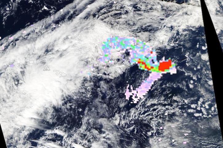
Image captured on Nov 28, 2022, by the MODIS and AIRS instruments aboard the Aqua satellite.
Worldview Image of the Week
Nov. 30, 2022

NASA Earth science data are being used in Africa’s Sahel region and across the continent to help track, study, and manage fires.
Feature Article
Nov. 16, 2022

Thirty-meter data from the Operational Land Imager aboard Landsat 8 and 9 offer greater resolution than MODIS and VIIRS.
Feature Article
Oct. 31, 2022

Data from NASA’s GES DISC help scientists like Dr. William Blackwell study the thermodynamics of tropical cyclones.
Data User Story
Oct. 27, 2022

Image captured on Oct 16, 2022, by the MODIS instrument aboard NASA's Aqua satellite.
Worldview Image of the Week
Oct. 17, 2022
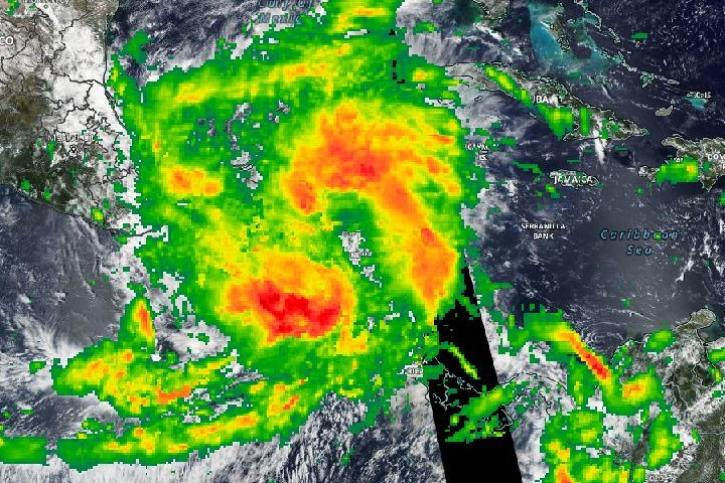
Image captured on Oct 10, 2022 by the MODIS instrument aboard NASA's Aqua satellite, with overlay of rain rate from IMERG.
Worldview Image of the Week
Oct. 11, 2022

Image captured on Sep 30, 2022 by the MODIS instrument aboard NASA's Aqua satellite.
Worldview Image of the Week
Oct. 6, 2022

Our experts break down the similarities and differences of Earth observation sensors operated by NASA.
Blog
Sept. 29, 2022
SHOWING 8 OF 356
Frequently Asked Questions
Earthdata Forum
Our online forum provides a space for users to browse thousands of FAQs about research needs, data, and data applications. You can also submit new questions for our experts to answer.
Submit Questions to Earthdata Forumand View Expert Responses