We are in the process of migrating all NASA Earth science data sites into Earthdata from now until end of 2026. Not all NASA Earth science data and resources will appear here until then. Thank you for your patience as we make this transition.
Read about the Web Unification Project
VIIRS Resources
Earthdata resources for users working with NASA’s Visible Infrared Imaging Radiometer Suite (VIIRS) data include tutorials and other learning resources, news announcements such as instrument updates and data releases, user guides and related documents, and frequently asked questions.
VIIRS Learning Resources

This advanced-level training focuses on using remote sensing observations for monitoring post-fire impacts on watershed health.
Training
July 6-13, 2023

This training will cover how soil moisture is modeled within LIS in to improve drought monitoring.
Training
May 17-31, 2023

Join us April 26 at 2 p.m., EDT [UTC -4], to learn about NASA's LAADS DAAC data migration to the cloud and what this means for data users regarding schedule and data access. A live demo of Amazon Simple Storage Service (S3) direct access in the cloud will be provided.
Webinar
April 9, 2023

This ARSET training focuses on developments and updates in flood monitoring tools and flood modeling techniques.
Training
Sept. 14-21, 2022

This ARSET training focuses on using NASA data products for monitoring human settlements and landscapes during armed conflict and forced displacement.
Training
June 14-23, 2022

This ARSET training focuses on introducing evapotranspiration (ET) products derived from remote sensing observations.
Training
June 1-15, 2022

Join us to learn how to search and order datasets from NASA's Level-1 and Atmosphere Archive and Distribution System Distributed Active Archive Center (LAADS DAAC). Subsetting, reprojection, and data output post-processing operations in the Find Data tool will also be featured.
Webinar
May 18, 2022

Near real-time monitoring of tropical storms and observations of previous hurricanes.
StoryMap
April 28, 2022
SHOWING 8 OF 73
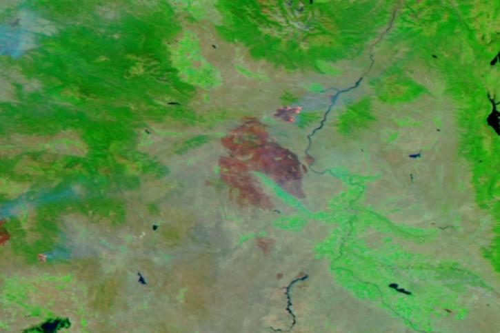
Image captured on July 23, 2024, by the VIIRS instrument aboard the joint NASA/NOAA NOAA-20 satellite.
Worldview Image of the Week
July 25, 2024

Image captured on July 17, 2024, by the VIIRS instrument aboard the joint NASA/NOAA NOAA-20 satellite.
Worldview Image of the Week
July 18, 2024
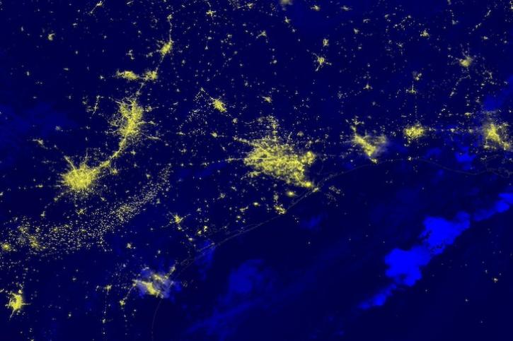
Image captured on July 9, 2024, by the VIIRS instrument aboard the joint NASA/NOAA NOAA-20 satellite.
Worldview Image of the Week
July 11, 2024

A summary of datasets, products, and resources released by NASA's Distributed Active Archive Centers (DAACs) in June 2024.
News
July 2, 2024
SHOWING 4 OF 387
Frequently Asked Questions
Earthdata Forum
Our online forum provides a space for users to browse thousands of FAQs about research needs, data, and data applications. You can also submit new questions for our experts to answer.
Submit Questions to Earthdata Forumand View Expert Responses