We are in the process of migrating all NASA Earth science data sites into Earthdata from now until end of 2026. Not all NASA Earth science data and resources will appear here until then. Thank you for your patience as we make this transition.
Read about the Web Unification Project
VIIRS Resources
Earthdata resources for users working with NASA’s Visible Infrared Imaging Radiometer Suite (VIIRS) data include tutorials and other learning resources, news announcements such as instrument updates and data releases, user guides and related documents, and frequently asked questions.
VIIRS Learning Resources

This three-part ARSET training covers flood monitoring via remote sensing, NASA flood products, and GEOGLOWS streamflow predictions.
Training
June 18-25, 2026

This ARSET training introduces participants to several capabilities within FIRMS that were not included in the previous ARSET training.
Training
Jan. 14-21, 2026

Join us on Wed., September 17, 2025, at 2:00 p.m. EDT (-04:00 UTC) to learn how to discover, access, and use NASA's near real-time global flood products .
Webinar
Aug. 29, 2025
Esta capacitación de ARSET ofrece a los participantes una introducción a los diferentes módulos de FIRMS.
Training
July 9-23, 2025

Agricultural burning in Kansas produces smoky skies and healthy crops.
Data in Action
June 6, 2025

A comparison of aurora forecasts with actual satellite observations suggests VIIRS DNB data can enhance space weather prediction efforts.
Data in Action
May 30, 2025
This ARSET training familiarizes participants with the various modules available in FIRMS and explores the range of data and information available.
Training
April 16-30, 2025

Our Earth Data Officer, Katie Baynes, spoke at the Federal GIS Conference Plenary. In case you missed her presentation, here is a story map for you to catch up on how NASA Earth data can be leveraged in your GIS project.
StoryMap
March 5, 2025
SHOWING 8 OF 73
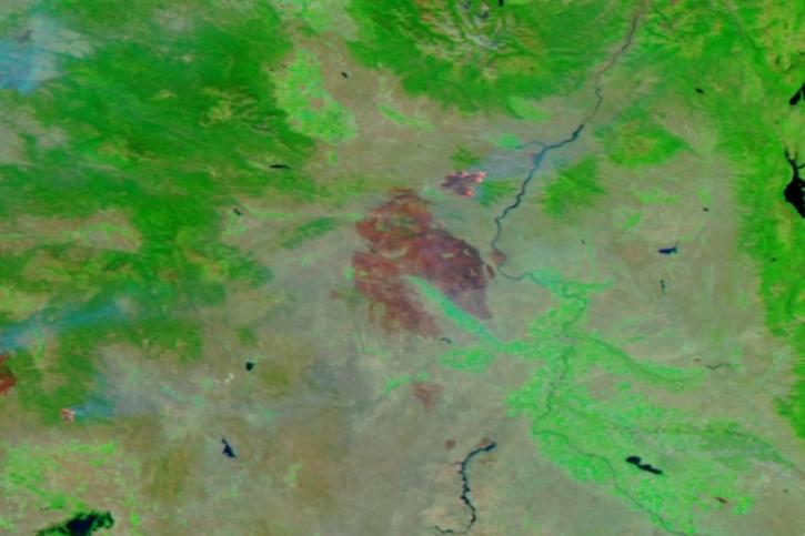
Image captured on July 23, 2024, by the VIIRS instrument aboard the joint NASA/NOAA NOAA-20 satellite.
Worldview Image of the Week
July 25, 2024

Image captured on July 17, 2024, by the VIIRS instrument aboard the joint NASA/NOAA NOAA-20 satellite.
Worldview Image of the Week
July 18, 2024
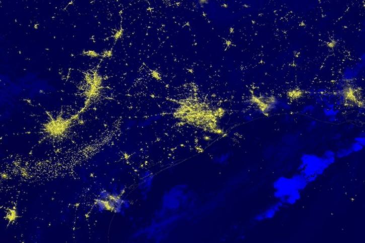
Image captured on July 9, 2024, by the VIIRS instrument aboard the joint NASA/NOAA NOAA-20 satellite.
Worldview Image of the Week
July 11, 2024

A summary of datasets, products, and resources released by NASA's Distributed Active Archive Centers (DAACs) in June 2024.
News
July 2, 2024
SHOWING 4 OF 387
Frequently Asked Questions
Earthdata Forum
Our online forum provides a space for users to browse thousands of FAQs about research needs, data, and data applications. You can also submit new questions for our experts to answer.
Submit Questions to Earthdata Forumand View Expert Responses