We are in the process of migrating all NASA Earth science data sites into Earthdata from now until end of 2026. Not all NASA Earth science data and resources will appear here until then. Thank you for your patience as we make this transition.
Read about the Web Unification Project
SMAP L-Band Radiometer Resources
Read the latest SMAP L-Band Radiometer news and access learning resources designed to help you optimize your Earth science research.
SMAP L-Band Radiometer Learning Resources

Satellite data reveals the impact of storm runoff on the coastal ocean.
Data in Action
March 1, 2023

This webinar will compare sea surface salinity data collected by the Aquarius and SMAP missions. We will showcase data visualization and data access tools available through NASA's Physical Oceanography Distributed Active Archive Center.
Webinar
April 19, 2022

This ARSET training reviews pre-fire risk assessment and post-fire mapping using open-source tools like Google Earth Engine.
Training
Jan. 18-20, 2022

Researchers used satellite and saildrone data to measure sea surface salinity in coastal waters freshened by river runoff in the Yukon Delta.
Data in Action
Oct. 5, 2021

This ARSET training provides an overview of NASA resources for monitoring climate change and its impacts.
Training
Sept. 29 - Oct. 6, 2021

Ocean researchers are studying the data consistency between different salinity products.
Data in Action
July 27, 2021

This ARSET training introduces how NASA earth observations can contribute to a greater understanding of energy management applications.
Training
June 1-22, 2021

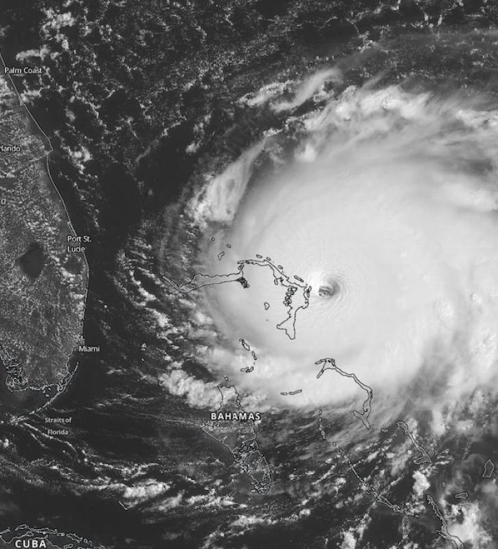
Satellite data reveals the oceanic response to the record-setting season.
Data in Action
March 25, 2021
SHOWING 8 OF 29

Data collected by the Saildrone unmanned surface vehicle have been turned into a new animation at NASA’s Physical Oceanography DAAC (PO.DAAC).
News
Nov. 4, 2020
Scientists at NASA's Short-Term Prediction Research and Transition (SPoRT) project use near real-time data to help the operational weather community with hurricane forecasting.
Feature Article
Nov. 4, 2020

Image of surface soil moisture on 24 March 2016 from the Soil Moisture Active Passive (SMAP) satellite.
Worldview Image of the Week
Feb. 26, 2020

Feature article describing NASA's SMAP mission and the roles that ASF DAAC will play with distributing the SAR data.
News
Feb. 6, 2020
SHOWING 4 OF 34
Frequently Asked Questions
Earthdata Forum
Our online forum provides a space for users to browse thousands of FAQs about research needs, data, and data applications. You can also submit new questions for our experts to answer.
Submit Questions to Earthdata Forumand View Expert Responses