We are in the process of migrating all NASA Earth science data sites into Earthdata from now until end of 2026. Not all NASA Earth science data and resources will appear here until then. Thank you for your patience as we make this transition.
Read about the Web Unification Project
S-SAR Resources
Earthdata resources for users working with NASA’s S-band synthetic aperture radar (S-SAR) aboard the NASA/Indian Space Research Organization SAR (NISAR) platform include tutorials and other learning resources, news announcements such as instrument updates and data releases, user guides and related documents, and frequently asked questions.
S-SAR Learning Resources
This data recipe guides users through the AWS sign-up sign-up and configuration processes before creating InSAR products.
Data Recipe
Oct. 18, 2015
SHOWING 1 OF 17

The ability for Synthetic Aperture Radar (SAR) to create high-resolution imagery regardless of atmospheric conditions makes it a key technology for studies of change over time. Dr. Paul Siqueira’s work improves these sensors and the Earth observing data they collect.
Data User Story
April 22, 2021
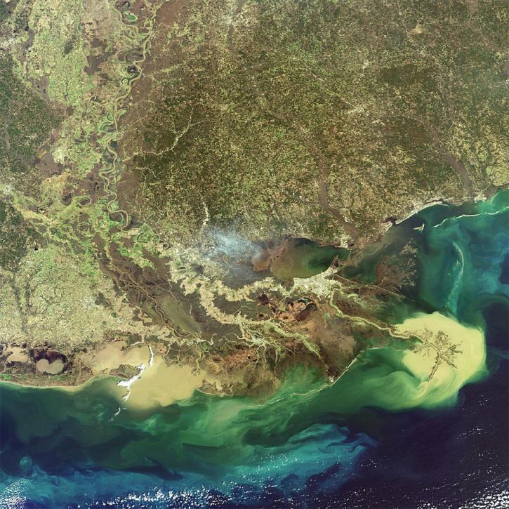
NASA researchers are using high resolution airborne data to determine the vulnerability and resilience of the Mississippi River Delta.
Feature Article
April 12, 2021

The upcoming NISAR satellite mission is expected to add as much as 85 TB of data each day to the EOSDIS archive. The commercial cloud is being explored as a way to archive and disseminate this extremely high volume of data efficiently.
Feature Article
Feb. 25, 2021
The joint NASA/Indian Space Research Organization SAR (NISAR) mission will provide the world with an unprecedented source of data, processing tools, and educational materials.
Data User Story
Jan. 7, 2021
SHOWING 4 OF 27
Frequently Asked Questions
Earthdata Forum
Our online forum provides a space for users to browse thousands of FAQs about research needs, data, and data applications. You can also submit new questions for our experts to answer.
Submit Questions to Earthdata Forumand View Expert Responses