We are in the process of migrating all NASA Earth science data sites into Earthdata from now until end of 2026. Not all NASA Earth science data and resources will appear here until then. Thank you for your patience as we make this transition.
Read about the Web Unification Project
OLI Resources
Earthdata resources for users working with NASA’s Operational Land Imager (OLI) include tutorials and other learning resources, news announcements such as instrument updates and data releases, user guides and related documents, and frequently asked questions.
OLI Learning Resources

This ARSET training provides an overview of carbon monitoring for terrestrial ecosystems.
Training
June 9 - July 7, 2016

This ARSET training focuses on regional and global observation resources for conservation management.
Training
May 5 - June 2, 2015
SHOWING 2 OF 82

Users of NASA’s Fire Information for Resource Management System (FIRMS) can now differentiate between fires caused by burning vegetation and fires from natural heat sources or industrial heat sources.
Blog
March 7, 2025

A summary of datasets, products, and resources released by NASA’s Distributed Active Archive Centers (DAACs) in February 2025.
News
March 6, 2025

These new vegetation indices offer the same near-global coverage, and 30-meter spatial resolution as the initial HLS products.
News
Feb. 19, 2025
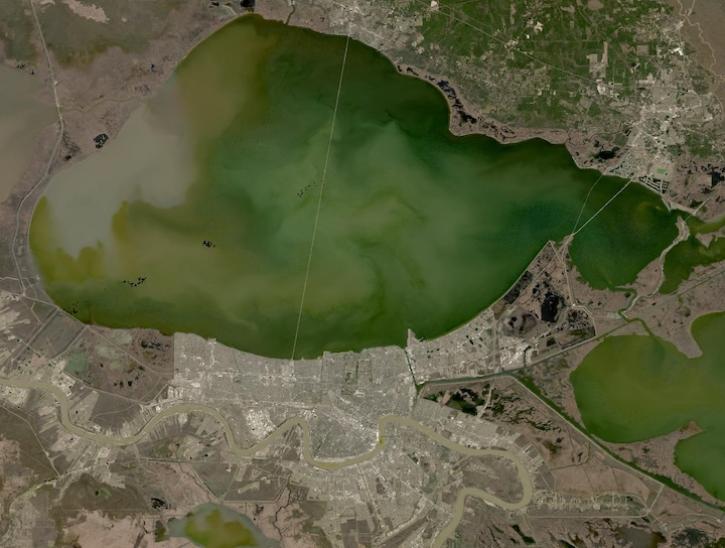
Image captured on February 2, 2025, from the OLI instrument aboard the Landsat 8 satellite.
Worldview Image of the Week
Feb. 6, 2025
SHOWING 4 OF 66
Frequently Asked Questions
Earthdata Forum
Our online forum provides a space for users to browse thousands of FAQs about research needs, data, and data applications. You can also submit new questions for our experts to answer.
Submit Questions to Earthdata Forumand View Expert Responses