
CDDIS News

Read the latest news stories, feature articles, user stories, and blog posts that feature data archived by NASA's Crustal Dynamics Data Information System (CDDIS).

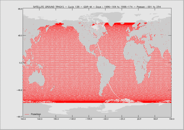
For real-time announcements about data outages, releases, and retirements, see our list of Data Alerts and Outages.

Filters
Who uses NASA Earth science data? Dr. Erricos C. Pavlis, to help accurately measure Earth.
Data User Story
Knowing the precise location of a satellite in space is critical for determining sea surface height and, through this, the rate of global mean sea level rise.
Feature Article
April 19, 2021
The Global Navigation Satellite System (GNSS) enables the precise location of points on Earth’s surface. For geodesists like Dr. Herring, it also is a key geodetic technique for his studies of surface deformation processes.
Data User Story
SHOWING 8 OF 34