We are in the process of migrating all NASA Earth science data sites into Earthdata from now until end of 2026. Not all NASA Earth science data and resources will appear here until then. Thank you for your patience as we make this transition.
Read about the Web Unification Project
Terrestrial Hydrosphere News
Articles, resources, and announcements from Terrestrial Hydrosphere.

Validated science data products from the Surface Water and Ocean Topography (SWOT) mission are available through NASA Earthdata Search.
News
Aug. 14, 2024

Image captured on August 7, 2024, by the MODIS instrument aboard NASA's Terra satellite.
Worldview Image of the Week
Aug. 8, 2024

A NASA-funded project is helping U.S. college students learn how to work with ECOSTRESS mission data and communicate the science behind these data.
News
July 23, 2024

A combination of Landsat and Sentinel-2 imagery, NASA near real-time data, and machine learning provides near real-time access to high-resolution water quality maps.
News
June 27, 2024
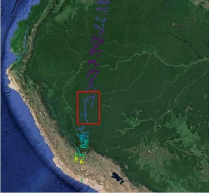
The Surface Water and Ocean Topography (SWOT) mission provides critical data for understanding Earth's water cycle, including data about freshwater systems that have not been available from any previous hydrology-related missions.
Data User Story
May 15, 2024
Using NASA Earth observation data, researchers assessed miles of Brazilian coastline to identify high-risk points of fish contaminated with microplastics.
Blog
May 8, 2024

Recently released datasets from the SWOT mission provide scientists with previously unavailable measurements of Earth's surface water.
Feature Article
April 25, 2024
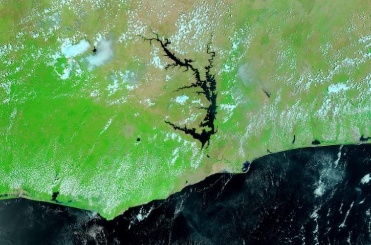
Image captured March 16, 2024, by the VIIRS instrument aboard the joint NASA/NOAA Suomi NPP satellite.
Worldview Image of the Week
March 21, 2024
SHOWING 8 OF 142