We are in the process of migrating all NASA Earth science data sites into Earthdata from now until end of 2026. Not all NASA Earth science data and resources will appear here until then. Thank you for your patience as we make this transition.
Read about the Web Unification Project
Water Quality News
Articles, resources, and announcements from Water Quality.

Image captured on Sep 30, 2022 by the MODIS instrument aboard NASA's Aqua satellite.
Worldview Image of the Week
Oct. 6, 2022
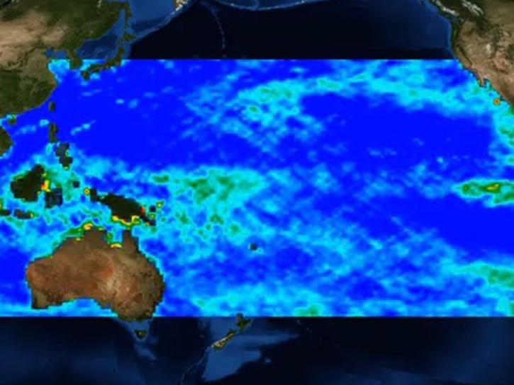
Researchers are using satellite data and machine learning to map microplastic concentrations across the ocean.
Feature Article
Jan. 31, 2022

CASEI improves information and data access for users of NASA airborne and field data.
Feature Article
July 9, 2021

Who uses NASA Earth science data? Adnan Al-Azri, to study why periodic harmful blooms of algae occur in the Sea of Oman and Arabian Sea.
Data User Story
April 22, 2021

Who uses NASA Earth science data? Mark Trice, to monitor the health of Chesapeake Bay.
Data User Story
April 22, 2021
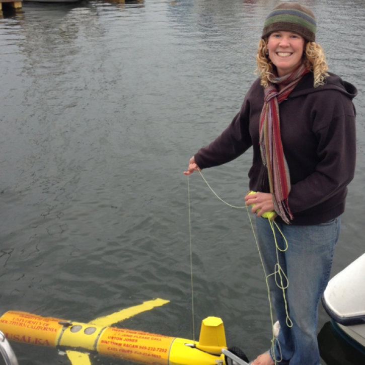
Who uses NASA Earth science data? Dr. Bridget Seegers, for developing new ways to study water quality and track harmful algal blooms.
Data User Story
April 22, 2021

This ArcGIS StoryMap highlights Data User Profiles, Learning Resources and Worldview imagery layers in support of Earth Day 2021.
Feature Article
April 19, 2021

A tiny organism and its tenants make an unexpected appearance.
Feature Article
Dec. 28, 2020
SHOWING 8 OF 25