We are in the process of migrating all NASA Earth science data sites into Earthdata from now until end of 2026. Not all NASA Earth science data and resources will appear here until then. Thank you for your patience as we make this transition.
Read about the Web Unification Project
Land Surface News
Articles, resources, and announcements from Land Surface.
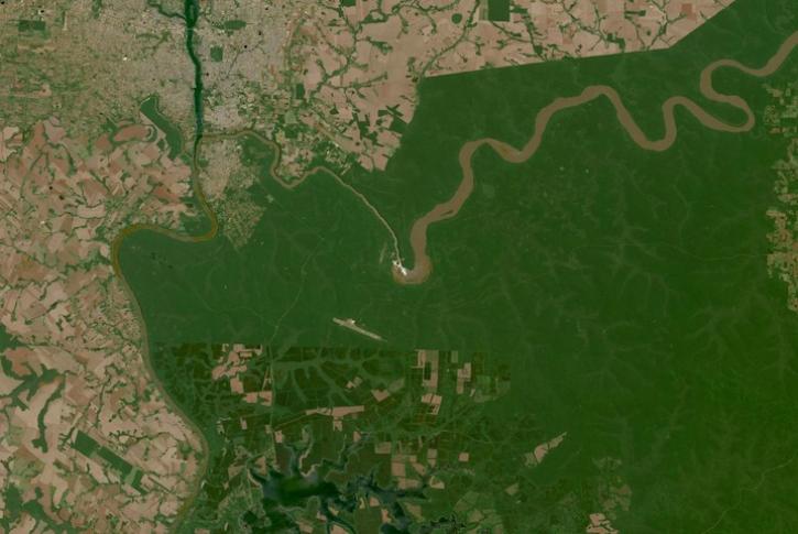
Image captured on Oct 10, 2023, by the OLI instrument aboard the Landsat 8 and 9 satellites.
Worldview Image of the Week
Oct. 19, 2023
OpenAltimetry, a cyberinfrastructure platform for working with data from NASA’s Ice, Cloud, and land Elevation Satellite (ICESat) and ICESat-2 missions, is now a full NASA Earth science application.
News
Oct. 5, 2023

NASA announces that RADARSAT-1 data are Open Data at NASA’s Alaska Satellite Facility Distributed Active Archive Center (ASF DAAC).
News
Oct. 2, 2023
The project, described as a “breakthrough for fire mapping from space,” is producing high resolution maps to help guide post-fire recovery and remediation efforts.
News
Sept. 7, 2023
Users can now access the full Harmonized Landsat and Sentinel-2 (HLS) data archive back to April 2013.
News
Sept. 6, 2023

Bock provides NASA's Crustal Dynamics Data Information System (CDDIS) with data products based on ground displacement data.
Data User Story
Aug. 24, 2023

Based on NASA's Harmonized Landsat Sentinel-2 (HLS) data, the artificial intelligence (AI) foundation model is a milestone in the application of AI for Earth science.
News
Aug. 3, 2023
Interferometric synthetic aperture radar (InSAR) data helps researchers study fault creep, which occurs when only part of the fault moves.
Data User Story
July 27, 2023
SHOWING 8 OF 285