On May 6 from 8:00 to 9:00 a.m. (US Eastern Time), the Data Catalog and Earthdata Search search may be temporarily unavailable due to maintenance of the NASA Common Metadata Repository (CMR).
Human Dimensions News
Articles, resources, and announcements from Human Dimensions.

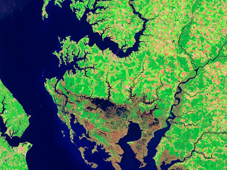
Image captured on 5 February 2021, by the MSI instrument, aboard ESA's Sentinel 2A and 2B satellites.
Worldview Image of the Week
Feb. 22, 2021

Image captured on 31 January 2021, by the VIIRS instrument, aboard the joint NASA/NOAA Suomi NPP satellite.
Worldview Image of the Week
Feb. 8, 2021
Data from NASA's Socioeconomic Data and Applications Center were used to create interactive maps included in the exhibit.
News
Feb. 5, 2021
Find EOSDIS dataset and data tool news, top stories, featured data images, webinars, links to new learning resources, data recipes, and data user profiles.
News
Jan. 27, 2021
Among many applications, the Atlas showcased the Global COVID-19 Viewer developed by NASA’s Socioeconomic Data and Applications Center.
News
Jan. 22, 2021

FIRMS US/Canada is a new version of Fire Information for Resource Management System (FIRMS).
Blog
Jan. 9, 2021

The Global Navigation Satellite System (GNSS) enables the precise location of points on Earth’s surface. For geodesists like Dr. Herring, it also is a key geodetic technique for his studies of surface deformation processes.
Data User Story
Jan. 7, 2021

Aerosols have a huge impact on climate and human health. Dr. Steven Massie uses remotely-sensed data to better understand these impacts and improve how aerosols are detected by Earth observing satellites.
Data User Story
Jan. 7, 2021
SHOWING 8 OF 851