We are in the process of migrating all NASA Earth science data sites into Earthdata from now until end of 2026. Not all NASA Earth science data and resources will appear here until then. Thank you for your patience as we make this transition.
Read about the Web Unification Project
Human Dimensions News
Articles, resources, and announcements from Human Dimensions.

Image captured on Sep 18, 2022 by the AHI instrument aboard the Himawari-8 satellite.
Worldview Image of the Week
Sept. 20, 2022

Image captured on Sep 10, 2022, by the VIIRS instrument aboard the joint NASA/NOAA Suomi NPP satellite.
Worldview Image of the Week
Sept. 13, 2022

Environmental and public health researchers may benefit from ground-level measurements of PM2.5, NO2, and O3 concentrations.
Feature Article
Sept. 13, 2022

The NASA Worldview Snapshots tool enables users to easily create satellite imagery subsets for anywhere in the world.
Blog
Sept. 11, 2022

Image captured on Sep 6, 2022 by the VIIRS instrument aboard the joint NASA/NOAA Suomi NPP satellite.
Worldview Image of the Week
Sept. 7, 2022

Image of a three-day flood composite ending Aug 30, 2022, from the MODIS instruments aboard the Terra and Aqua satellites.
Worldview Image of the Week
Aug. 30, 2022
The app enables users to overlay multiple data layers, including precipitation, storm track, and sea surface temperature.
News
Aug. 24, 2022
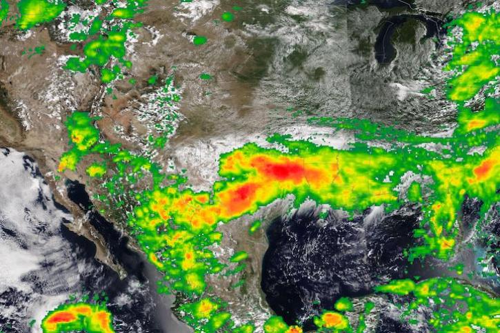
Image captured on Aug 22, 2022, by the VIIRS instrument aboard the joint NASA/NOAA NOAA-20 satellite.
Worldview Image of the Week
Aug. 23, 2022
SHOWING 8 OF 850