We are in the process of migrating all NASA Earth science data sites into Earthdata from now until end of 2026. Not all NASA Earth science data and resources will appear here until then. Thank you for your patience as we make this transition.
Read about the Web Unification Project
Natural Hazards News
Articles, resources, and announcements from Natural Hazards.
Read about the latest EOSDIS work in the Fall 2021 EOSDIS Update newsletter.
News
Jan. 26, 2022
Synthetic aperture radar may give researchers an opportunity to study volcanoes in finer detail than ever before.
Data User Story
Jan. 23, 2022

FIRMS recently added a location tool to enable users to easily find and save places of interest.
Blog
Jan. 11, 2022

Image captured on 25 July 2021, by the VIIRS instrument, aboard the joint NASA/NOAA Suomi NPP satellite.
Worldview Image of the Week
Jan. 10, 2022

Images captured between Jul 27 and Aug 2, 2021, by the MODIS instrument aboard NASA's Aqua satellite.
Worldview Image of the Week
Jan. 4, 2022

Image captured on 18 July 2021, by the VIIRS instrument, aboard the joint NASA/NOAA Suomi NPP satellite.
Worldview Image of the Week
Jan. 4, 2022

Image captured on Aug 7, 2021, by the MODIS instrument aboard NASA's Aqua satellite.
Worldview Image of the Week
Jan. 4, 2022
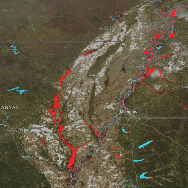
New Near Real-Time (NRT) Global Flood Mapping product from LANCE will continue production of data critical for detecting floods around the globe.
Feature Article
Dec. 27, 2021
SHOWING 8 OF 521