We are in the process of migrating all NASA Earth science data sites into Earthdata from now until end of 2026. Not all NASA Earth science data and resources will appear here until then. Thank you for your patience as we make this transition.
Read about the Web Unification Project
Human Dimensions Learning Resources
Webinars, tutorials, data recipes and more to help you work with Human Dimensions.
Filters

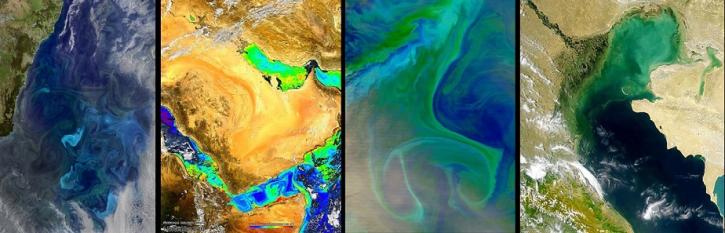
Evaluating the evolution of ocean response to the 2019 Atlantic tropical cyclones.
Data in Action
April 2, 2020

This ARSET training focuses on how to apply the UN Biodiversity Lab and NASA satellite data to conservation and SDG goals.
Training
March 24 - April 7, 2020
Cette formation ARSET est axée sur l'utilisation des données du Laboratoire de biodiversité des Nations Unies et des données satellitaires de la NASA.
Training
March 24 - April 7, 2020
Esta capacitación de ARSET se centra en cómo aplicar los datos del UN Biodiversity Lab y satélites de la NASA a las metas de los ODS.
Training
March 24 - April 7, 2020
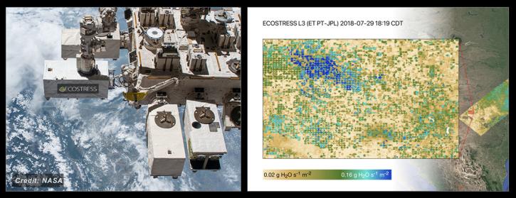
NASA's ECOSTRESS Mission studies how plants use water by measuring their temperature from space. Join us to learn more about ECOSTRESS mission measurements, data and tools!
Webinar
Feb. 18, 2020
NASA's Ocean Biology Distributed Active Archive Center (OB.DAAC) manages, archives and distributes nearly 40 years of ocean color, sea surface temperature, and sea surface salinity data. Join us to learn more about NASA ocean color data, services and tools!
Webinar
Feb. 18, 2020

This ARSET training focuses on the analysis and interpretation of long-term IMERG data for extreme dry and wet period monitoring and management.
Training
Jan. 28 - Feb. 4, 2020
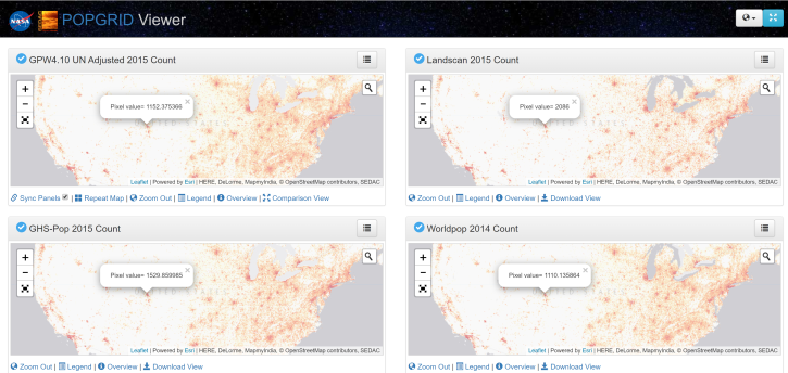
Introduction to gridded population and settlement data, an overview of gridding approaches and a demonstration on how to work with these data using SEDAC's POPGRID Viewer.
Webinar
Jan. 15, 2020
SHOWING 8 OF 332
Frequently Asked Questions
Earthdata Forum
Our online forum provides a space for users to browse thousands of FAQs about research needs, data, and data applications. You can also submit new questions for our experts to answer.
Submit Questions to Earthdata Forumand View Expert Responses