We are in the process of migrating all NASA Earth science data sites into Earthdata from now until end of 2026. Not all NASA Earth science data and resources will appear here until then. Thank you for your patience as we make this transition.
Read about the Web Unification Project
Cryosphere News
Articles, resources, and announcements from Cryosphere.
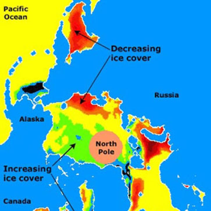
Arctic sea ice cover is an essential ingredient of Earth's climate system; ocean currents can influence climate by redistributing heat, especially in coastal regions.
Feature Article
July 21, 2020

Extent of Arctic sea ice is seen as a sensitive indicator of climate change.
Feature Article
July 21, 2020

A dataset with digital elevation models (DEMs) of the Greenland Ice Sheet is the latest release from NASA’s Oceans Melting Greenland (OMG) mission.
News
July 9, 2020

Image captured on 15 February 2020, by the MODIS instrument, aboard the Aqua satellite.
Worldview Image of the Week
June 30, 2020

Three new datasets show more than 17 years of variations in ice mass and ice mass changes from Antarctica and Greenland as well as global ocean mass change.
News
April 6, 2020

Image captured on 7 December 2018, by the MODIS instrument, aboard the Terra satellite.
Worldview Image of the Week
Feb. 26, 2020

Feature article describing NASA's SMAP mission and the roles that ASF DAAC will play with distributing the SAR data.
News
Feb. 6, 2020

GIBS now has Soil Moisture Active Passive (SMAP) layers available for soil moisture and temperature, snow mass, heterotrophic respiration, and more.
Blog
Feb. 9, 2016
SHOWING 8 OF 161