We are in the process of migrating all NASA Earth science data sites into Earthdata from now until end of 2026. Not all NASA Earth science data and resources will appear here until then. Thank you for your patience as we make this transition.
Read about the Web Unification Project
Filters

NASA's Socioeconomic Data and Applications Center (SEDAC) held its annual User Working Group meeting May 30‒31, 2023.
News
June 1, 2023

OpenScienceLab promotes open science by reducing barriers to working with synthetic aperture radar (SAR) data in the cloud.
Feature Article
May 31, 2023

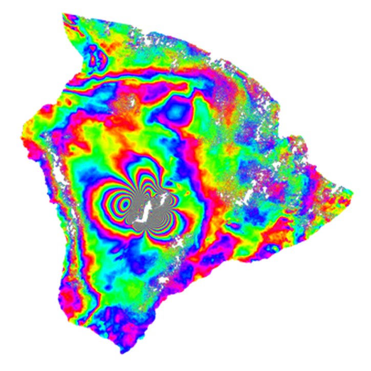
NASA's Jet Propulsion Laboratory (JPL)/CalTech Advanced Rapid Imaging and Analysis (ARIA) Project utilizes Synthetic Aperture Radar (SAR) data and Global Positioning System (GPS) for detecting and measuring ground deformation and creating predictive models.
News
May 31, 2023
A NASA-funded project is making synthetic aperture radar (SAR) data easier to work with—and preparing NASA for a SAR data explosion.
Feature Article
May 30, 2023
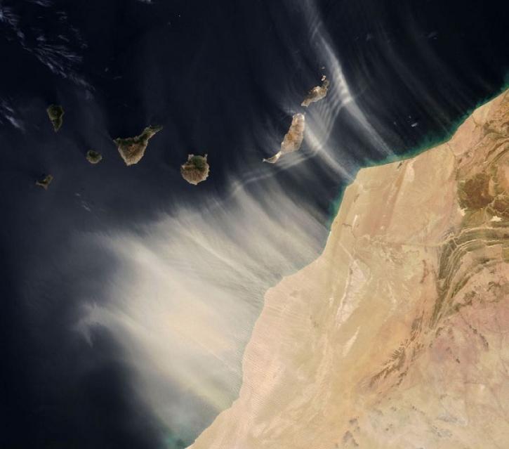
Data from the EMIT instrument help scientists better understand the role mineral dust plays in heating and cooling the atmosphere.
Feature Article
May 26, 2023

Image captured on May 23, 2023, by the AHI instrument aboard the Himawari-8 satellite.
Worldview Image of the Week
May 25, 2023

Data from NASA’s Land Processes DAAC help Dr. Helen Poulos understand climate-induced change in the forests of the Southwestern U.S.
Data User Story
May 25, 2023

The release of the HLS codebase gives product users greater visibility into the project’s image processing pipeline.
News
May 19, 2023
SHOWING 8 OF 2379