We are in the process of migrating all NASA Earth science data sites into Earthdata from now until end of 2026. Not all NASA Earth science data and resources will appear here until then. Thank you for your patience as we make this transition.
Read about the Web Unification Project
Filters
This data recipe guides users through the AWS sign-up sign-up and configuration processes before creating InSAR products.
Data Recipe
Oct. 18, 2015
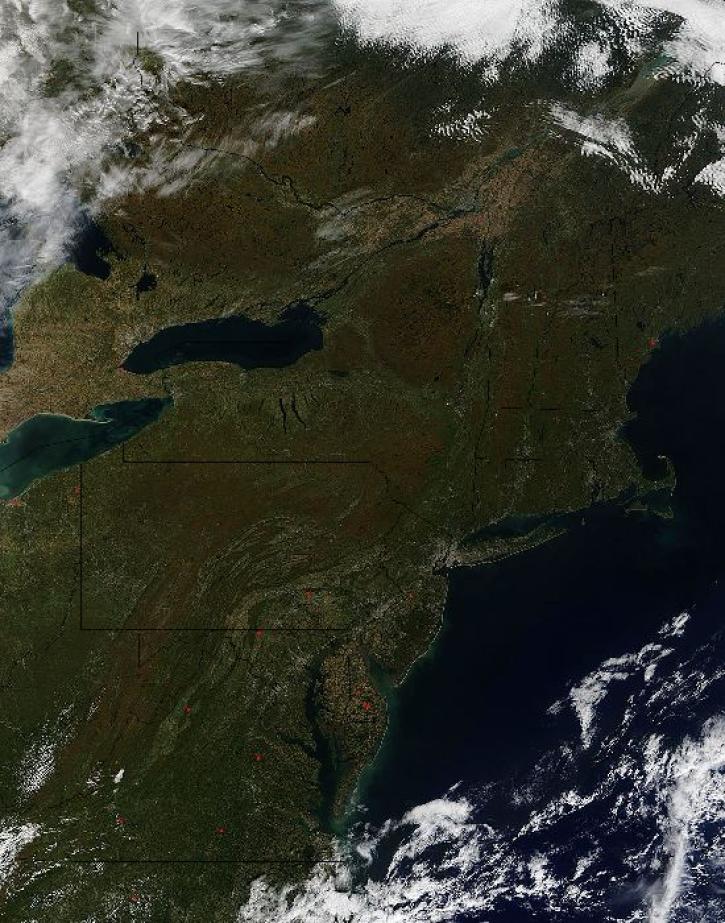
Image captured by the MODIS instrument, aboard the Terra satellite, on 12 October 2015 at 16:05 UTC.
Worldview Image of the Week
Oct. 15, 2015
This data recipe guides you through creating a Digital Elevation Model (DEM) from two Sentinel-1 SLC scenes.
Data Recipe
Oct. 2, 2015

Discover how MODIS data help track changes in snow water equivalents in the Sierra Nevada Mountains to help forecast drought in California.
Data in Action
Sept. 30, 2015

Learn how more recent anomalies are compared with previous El Niño events to gain a potential sense about future development and related impacts.
Data in Action
Sept. 3, 2015

Examining changes and recovery of the Chandeleur Barrier Islands post-Hurricane Katrina using remote sensing data.
Data in Action
Aug. 26, 2015

Four Level 1 global radiometer products recently have been added to the list of Worldview active layers.
Blog
Aug. 12, 2015
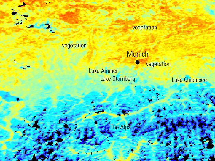
NASA Earth observation data is used to map urban heat patterns in Munich, predict wildfire risk in Sardinia using vegetation phenology, and identify archaeological resource networks in Peru.
Data in Action
Aug. 5, 2015
SHOWING 8 OF 2379