We are in the process of migrating all NASA Earth science data sites into Earthdata from now until end of 2026. Not all NASA Earth science data and resources will appear here until then. Thank you for your patience as we make this transition.
Read about the Web Unification Project
Filters

Issues with VIIRS near real-time products and some MODIS near real-time atmosphere products have been resolved.
Blog
March 23, 2017

The West Africa Atlas uses ASTER data, aerial imagery, and ground images to illustrate changes and responses to environmental challenges in 17 countries.
Data in Action
March 1, 2017

Learn how the Oceans Melting Greenland (OMG) projects surveys Greenland’s glaciers and ice sheets and studies how the oceans and ice interact with each other.
Data in Action
Feb. 27, 2017

Image captured on 20 February 2017 by the VIIRS instrument, aboard the joint NASA/NOAA Suomi NPP satellite.
Worldview Image of the Week
Feb. 21, 2017
Based on directives from the US Department of Homeland Security, we are required to transition our public-facing web services to use the HTTPS protocol and deprecate support for HTTP.
Blog
Feb. 17, 2017
Learn how to interpret quality information within Visible Infrared Imaging Radiometer Suite (VIIRS) Surface Reflectance data.
Tutorial
Feb. 13, 2017
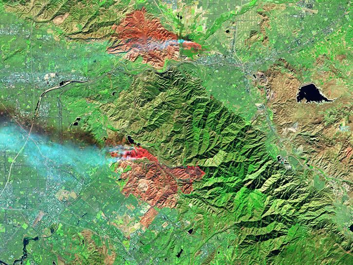
Image captured on 12 February 2017 by the MODIS instrument, aboard the Aqua satellite.
Worldview Image of the Week
Feb. 13, 2017

Satellite data from NASA's MODIS instrument illustrates the relationship between snow cover and temperature and the viability of skiing conditions over time.
Data in Action
Feb. 2, 2017
SHOWING 8 OF 2379