We are in the process of migrating all NASA Earth science data sites into Earthdata from now until end of 2026. Not all NASA Earth science data and resources will appear here until then. Thank you for your patience as we make this transition.
Read about the Web Unification Project
Filters

Data from NASA’s ICESat-2 mission provide incredibly accurate measurements of Earth elevation change—and much more.
Feature Article
Nov. 4, 2020
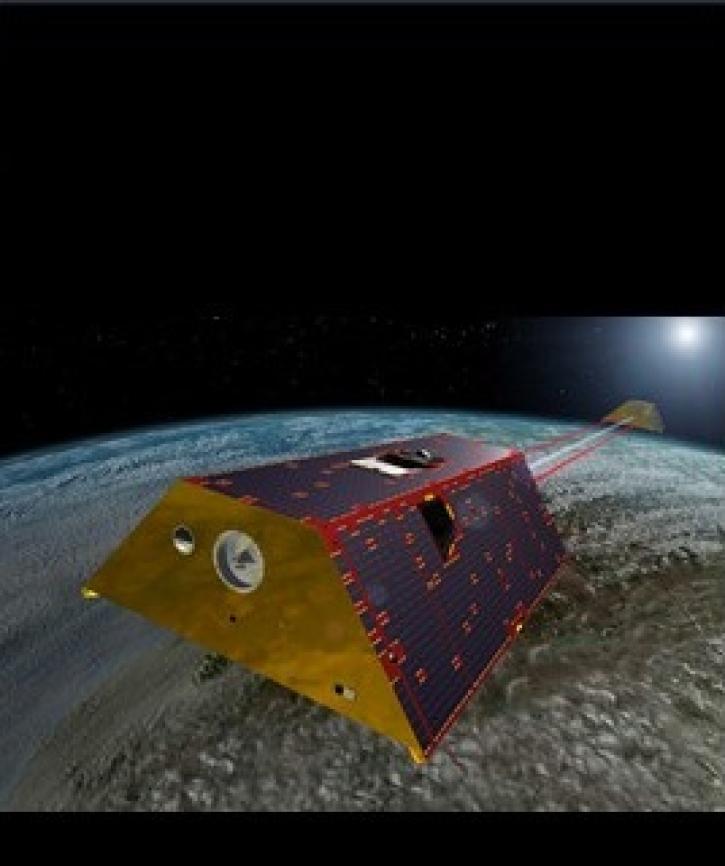
Two datasets from the Gravity Recovery and Climate Experiment Follow-On (GRACE-FO) mission have just been released by NASA’s PO.DAAC.
Feature Article
Nov. 4, 2020
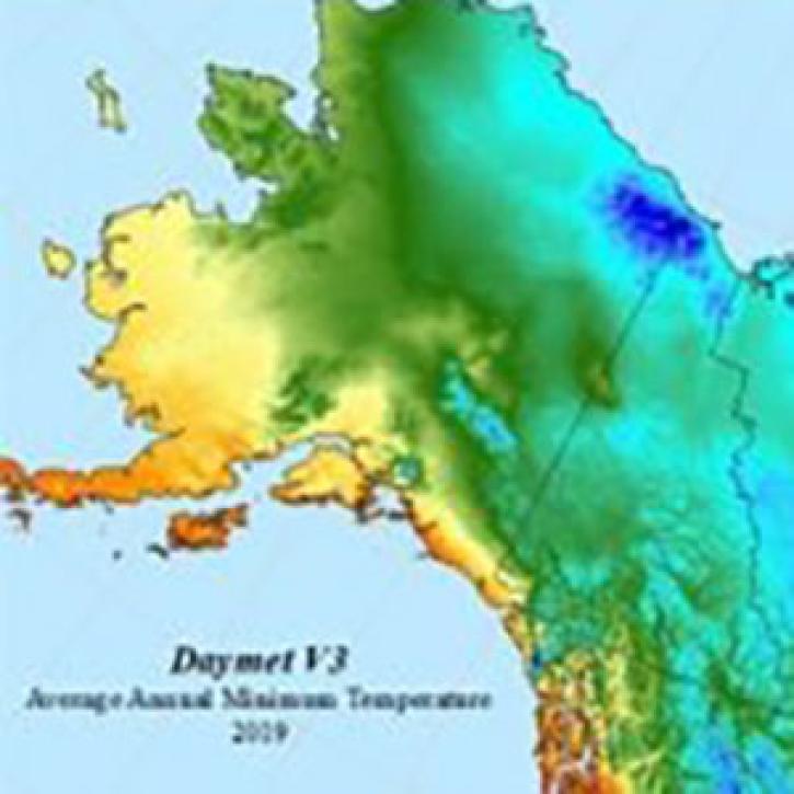
The Daymet dataset at NASA’s Oak Ridge National Laboratory Distributed Active Archive Center (ORNL DAAC) provides nearly 40 years of environmental data about North America.
Feature Article
Nov. 4, 2020

A recent study reviewed the impact of satellite data in accurately forecasting the path of Hurricane Sandy. The study showed that AIRS NRT data from NASA’s polar-orbiting satellites significantly improve these predictions.
Feature Article
Nov. 4, 2020

The most recent GPW update brings new maps and greater utility to SEDAC’s flagship data collection.
News
Nov. 4, 2020

Data from the Oceans Melting Greenland (OMG) mission provide a revolutionary look at ocean/ice interactions and estimates of global sea level rise.
News
Nov. 4, 2020

Version 3 of the ASTER Global Digital Elevation Model (GDEM) provides new features and sharper imagery.
News
Nov. 4, 2020

NASA’s ACCESS Program helps create and enhance technologies that make EOSDIS data more available for global interdisciplinary research.
Feature Article
Nov. 4, 2020
SHOWING 8 OF 2379