We are in the process of migrating all NASA Earth science data sites into Earthdata from now until end of 2026. Not all NASA Earth science data and resources will appear here until then. Thank you for your patience as we make this transition.
Read about the Web Unification Project
Filters
First PREFIRE Datasets Released on NASA Earthdata
News
Aug. 27, 2025

A training offered by NASA's ARSET program explores how to assess projected statistics of extreme heat and cold wave events, and extreme precipitation excess and deficit events, with NEX-GDDP-CMIP6 data.
News
Aug. 25, 2025

These Level 1, 2, and 3 datasets from the PREFIRE mission will allow researchers to study polar processes and variations with greater precision.
News
Aug. 22, 2025
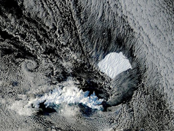
Image captured on August 17 and 19, 2025, by the MODIS instrument aboard the Aqua platform.
Worldview Image of the Week
Aug. 21, 2025

Giovanni and Panoply are dynamic data tools that enable users to create a plot of data values in a data map and produce related visualizations.
News
Aug. 19, 2025

Learn how to create a Giovanni data map, download the corresponding netCDF file, open the file with Panoply, and create line plots.
Tutorial
Aug. 19, 2025

This image was captured on August 14, 2025, by the VIIRS instrument aboard the joint NASA/NOAA NOAA-20 platform.
Worldview Image of the Week
Aug. 14, 2025

A summary of datasets, products, and resources released by NASA’s Distributed Active Archive Centers (DAACs) in July 2025.
News
Aug. 13, 2025
SHOWING 8 OF 2379